| Historical Maps of Hartley last updated 31.7.10 |
|
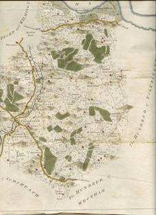
Larger
image (402kb jpeg) |
1769 This is the first large scale map to show Hartley, which was included in Hasted's History of Kent in 1797. It was drawn by Andrews, Drury and Herbert in 1769 at a scale of 2 inches to the mile. They produced maps for each hundred (administrative unit). The picture on the left is an extract of their map for Axstane Hundred - roughly equivalent to the later Dartford Rural District Council. The detail is astounding, but they did miss a few houses (eg. Brickend, Woodins, New House Farm and the Black Lion) and Hartley Wood is probably larger than it should be, but this in no way should detract from the mapmakers' great achievement. The picture we get is one that is that that had existed from the 1600s. The only roads were Ash Road, Church Road, Castle Hill, St Johns Lane, Manor Lane, Grange Lane, Hartley Hill and Hartley Bottom Road. Most of the houses are faithfully reproduced, for example in Manor Lane leading from Stocks Farm you can see Hartley Wood Corner and Hartley Manor. The scan of this map has been kindly supplied by The Old Map Shop, whose list of maps and prints for sale can be viewed at http://theoldmapshop.com/ |
|
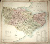
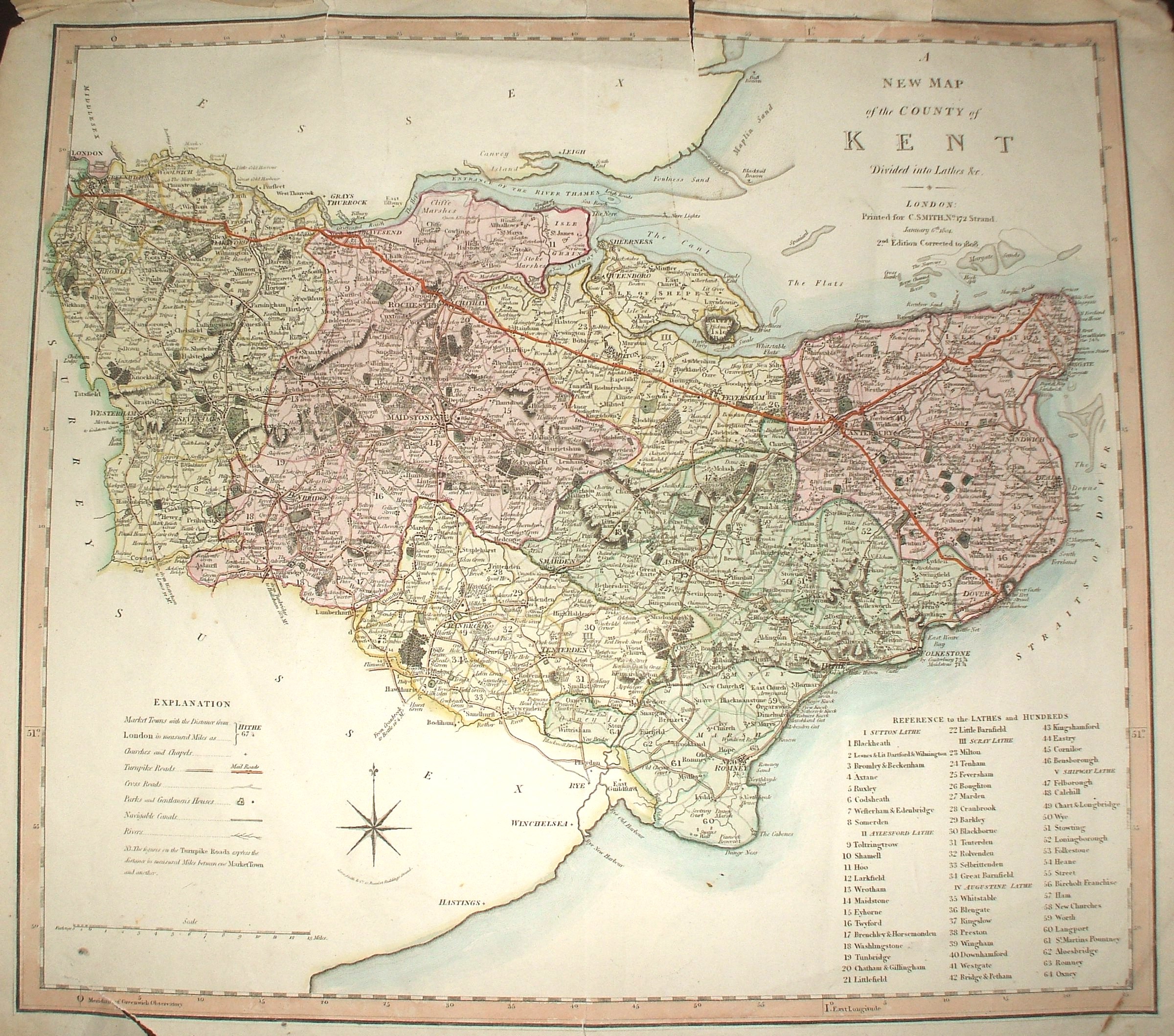
Larger image (1.26Mb jpeg) |
1808 This wonderfully detailed map of Kent was published by C Smith of 172 Strand, London in 1808. Then of course the county extended as far as Deptford. The north-western part of the county coloured yellow is Sutton at Hone lathe - the most ancient administrative area, within this Hartley, Longfield and Ash fall in the area edged yellow and numbered 4 - Axton Hundred. The turnpike (toll) roads are shown in yellow, for example from Dartford to Farningham, while the main turnpike roads on which the Mail coaches also ran are shown red - the future A2 is clearly visible as one of these. It is not altogether accurate for settlements - the houses marked only show the general location), and 1769 map is better for minor roads. But it is a powerful representation of a settlement pattern that would have changed little from the middle ages. |
|
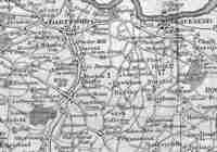
Larger image (62kb jpeg) |
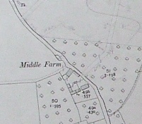
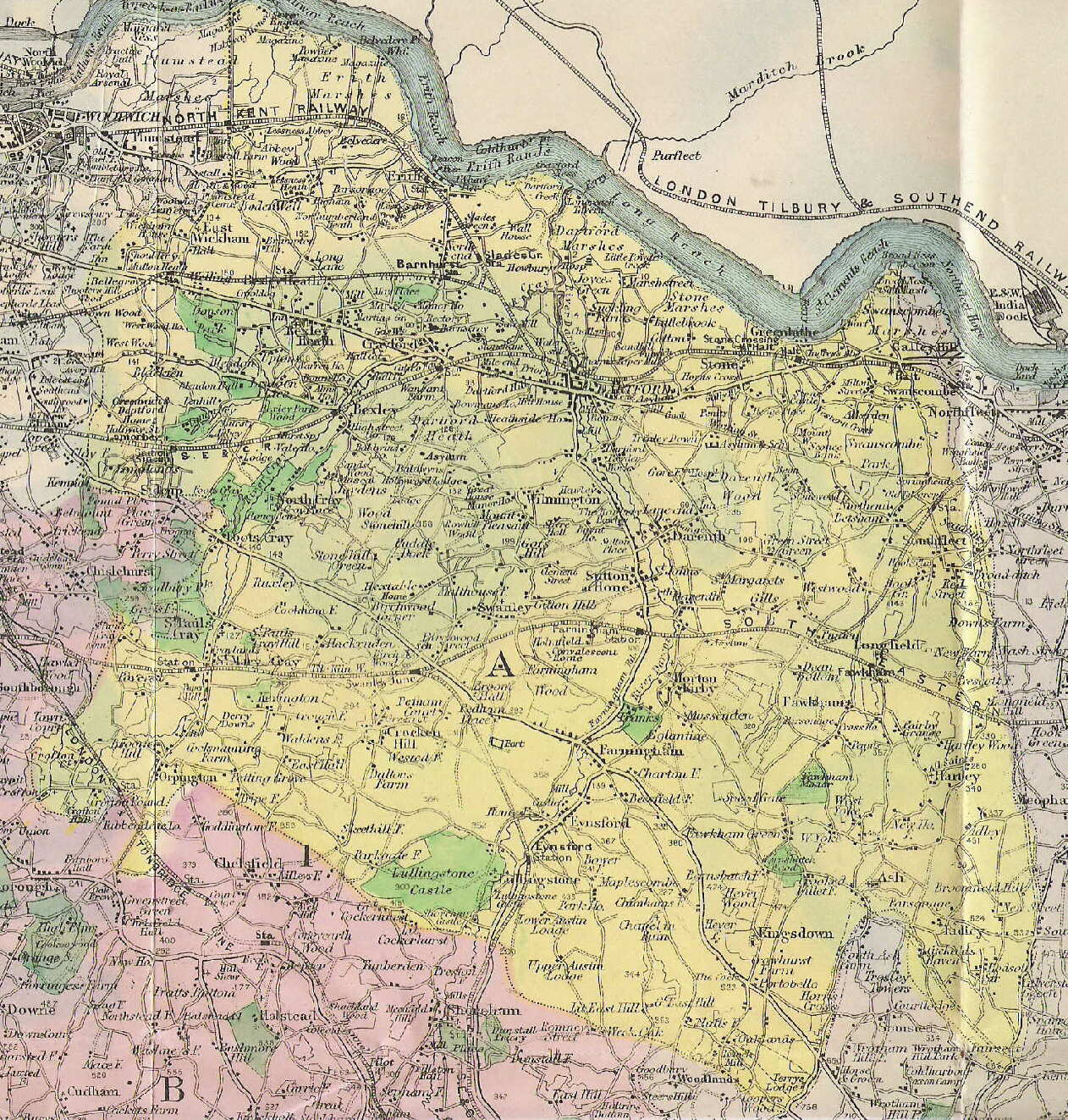
1833 This map was published by G Virtue of 26 Ivy Lane in 1833. It appears to be largely based on the Smith map of 1808. The bolder roads are the main turnpike (toll) roads, with the distance from London being inserted in italics. The dotted line running to the east of Hartley is the border of Sutton at Hone lathe - one of the most ancient administrative area. The 1 represents Axton Hundred - a sub-administrative area. Other hundreds are Dartford and Willmington (5) and Toltingtrough (17). |
|
1844 Tithe map, a very large scale map and schedule showing every field and house. It lists all owners and occupiers, what the land was used for and how many acres each field was. |
|
|
Larger
image (797kb jpeg) |
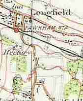
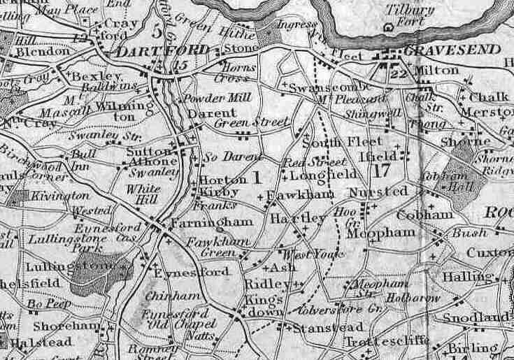
1868 One of the first parliamentary boundary reviews was conducted this year. Hartley was then part of a vast West Kent constituency that stretched from Tunbridge Wells to Greenwich to Dartford. 1869 The first published (the 1795 survey was mapped at 6" but published at 1" scale) Ordnance Survey large scale map of Kent at 6 inches to the mile has been scanned in by British History On-line. |
|
Larger image of whole map (414kb jpeg) |
1893 |
|
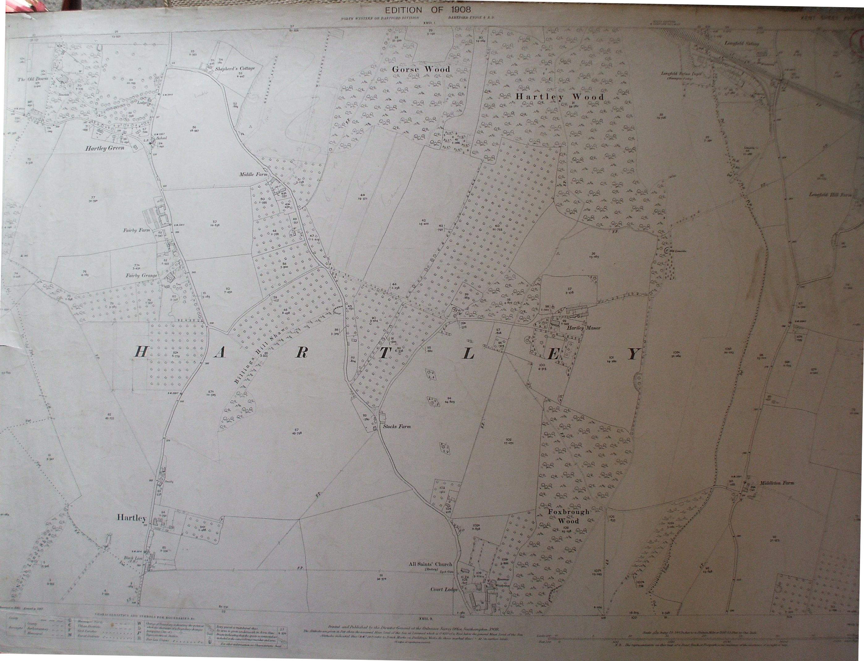
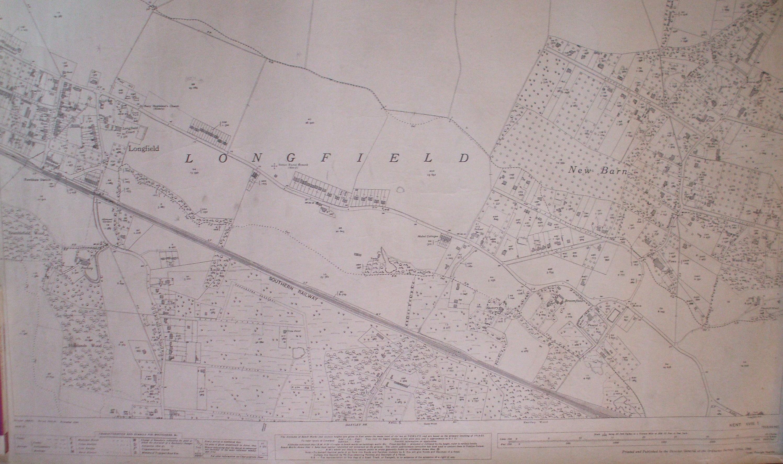
Larger image of whole map (672kb jpeg) |
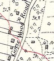
1908 The 1908 map is really a milestone in Hartley's history. This 25 to 1 inch large scale map shows Hartley on the eve of the developments which would transform the village forever. But the beginnings of the future are there to be seen as the ghostly outlines of Woodland Avenue, Wellfield, Gresham Avenue, Merton Avenue and Larksfield are to be seen. |
|
Larger image of whole map (102kb jpeg) |
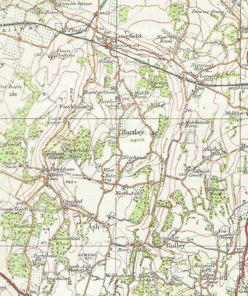
1914 |
|
Larger image of whole map (1.2mb jpeg) |
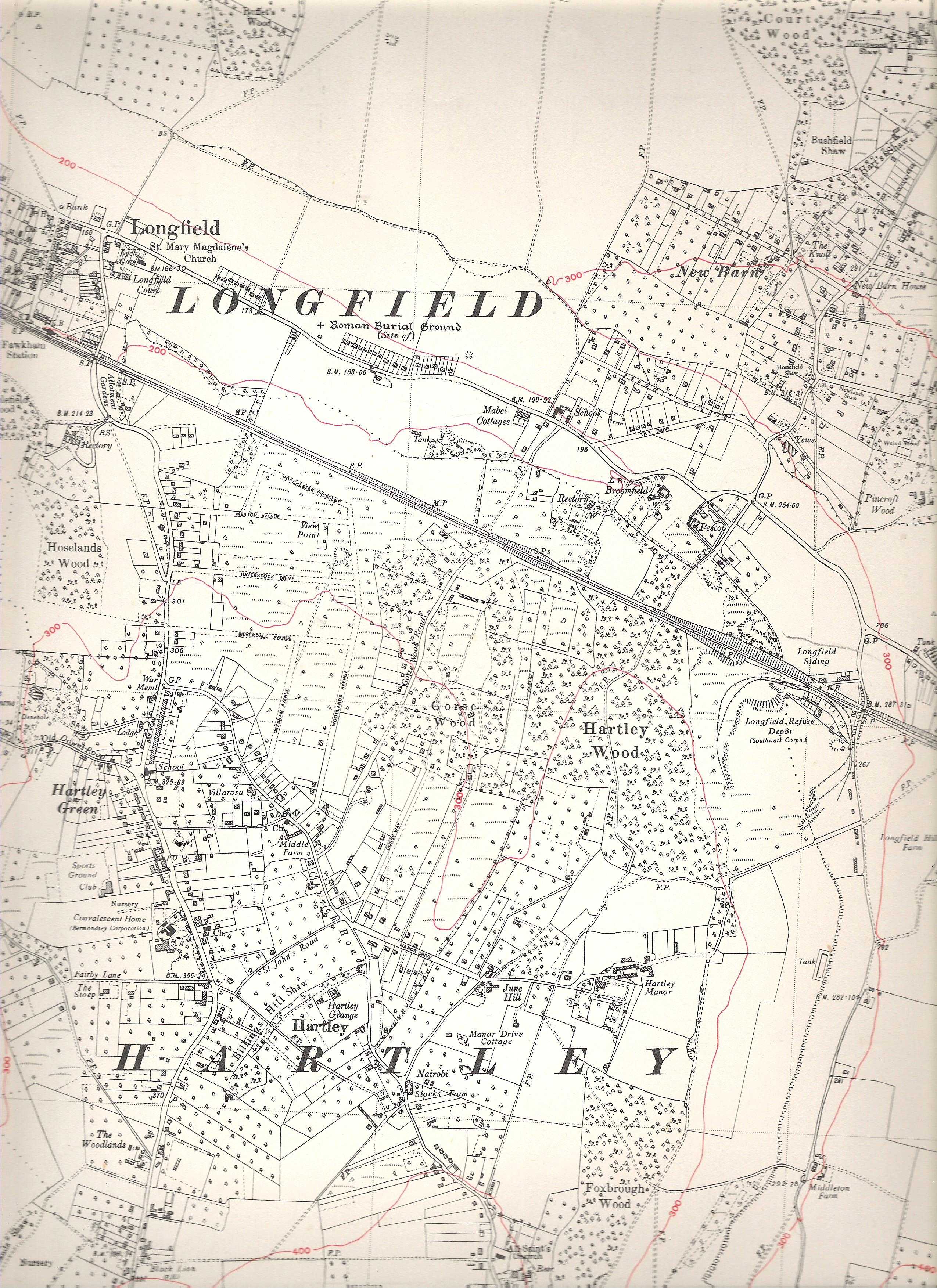
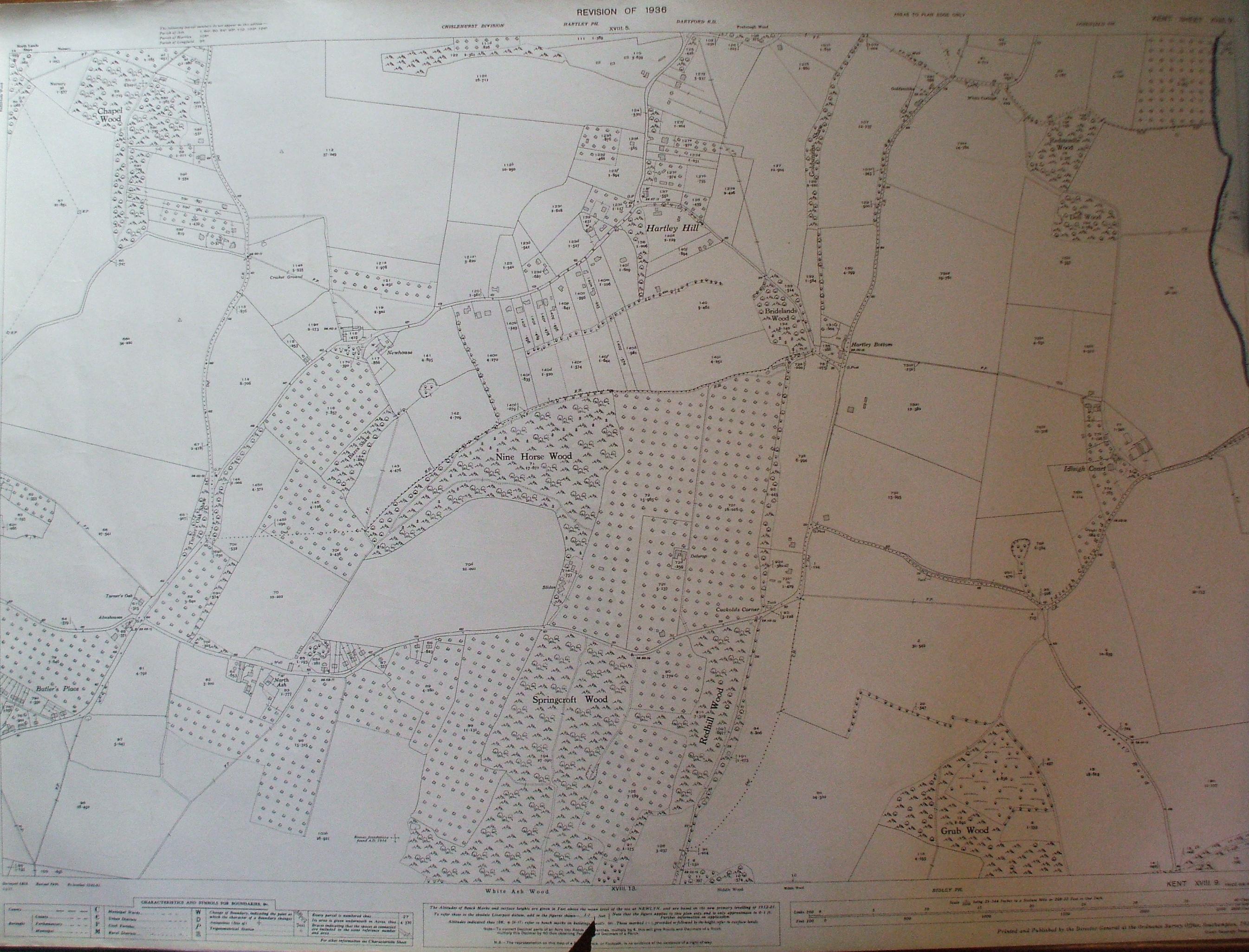
1936 All of Hartley on one map sheet! The first 6 inch to one mile map shows the effects of development in Hartley since the purchase of the land by Small Owners Limited in 1913. (there is some blurring at the edges from being an A3 size map put on an A4 size scanner) |
|
Larger images of whole map |
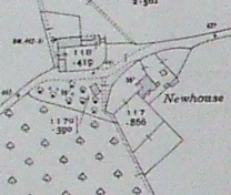
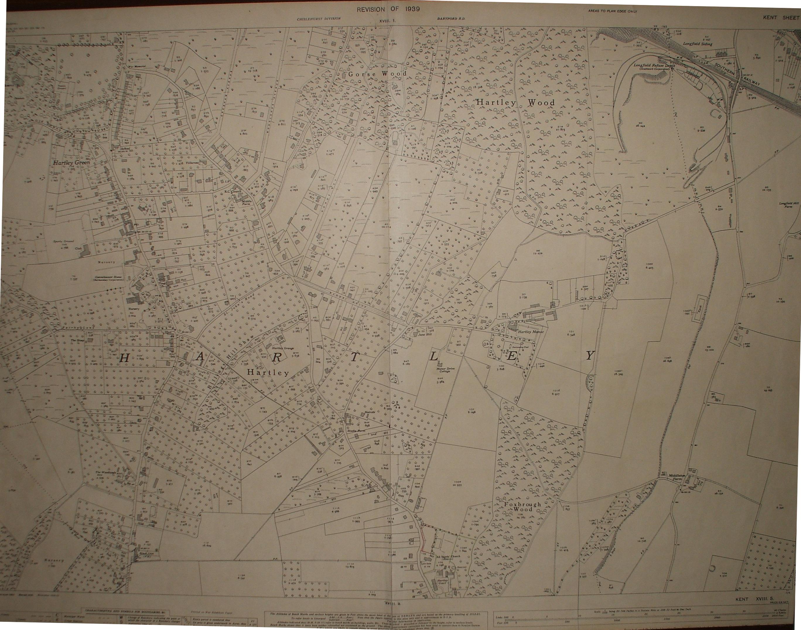
1938-9 This is the 25 inch to one mile scale map that followed the previous edition in 1908. Naturally there have been many changes, but some lie in the future. The extract pictured here shows New House Farm, Church Road, demolished to make way for New Ash Green. Just after the war came a new edition of the 1 inch to 1 mile OS map in 1946. |

