Map of Hartley and Dartford Area in 1833
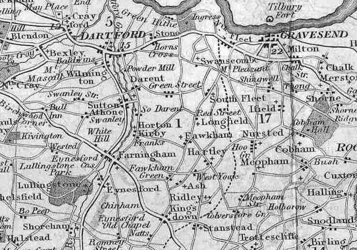
This map was published by G Virtue of 26 Ivy Lane in 1833. It is not altogether accurate (the houses marked for example only show the general location of settlements). But it is a powerful representation of a settlement pattern that would have changed little from the middle ages.
The bolder roads are the main turnpike (toll) roads, with the distance from London being inserted in italics. The dotted line running to the east of Hartley is the border of Sutton at Hone lathe - one of the most ancient administrative area. The 1 represents Axton Hundred - a sub-administrative area. Other hundreds are Dartford and Willmington (5) and Toltingtrough (17).