Click Here for Site Index 

Roads of Hartley - Chantry Avenue updated 11.9.2010

Gallery
Click on image for larger picture
Chantry Avenue, Hartley - from Fairby Lane Entrance
From Fairby Lane entrance

Chantry Avenue, Hartley - from Ash Road entrance
Ash Road entrance

Chantry Avenue, Hartley - from Corinthians Golf Course
Chantry Avenue and Fairby Lane from the other side of the Corinthians golf course

Playground at Chantry Avenue, Hartley 1999
Playground at Chantry Avenue, Hartley 1999 
Two pictures of the Parish Council playground (taken in 1999)

Postcode
DA3 8DD

Council Tax
18 x Band E, 36 x Band F, 5 x Band G (59 properties)
8 properties are flagged for review next time they are sold

KCC Road Number:
U14682 - Unclassified single carriageway (496 metres / 0.31 miles long)

Housing density (with 2-16 St Johns Lane)
8.4 houses per acre (6.99 acres)

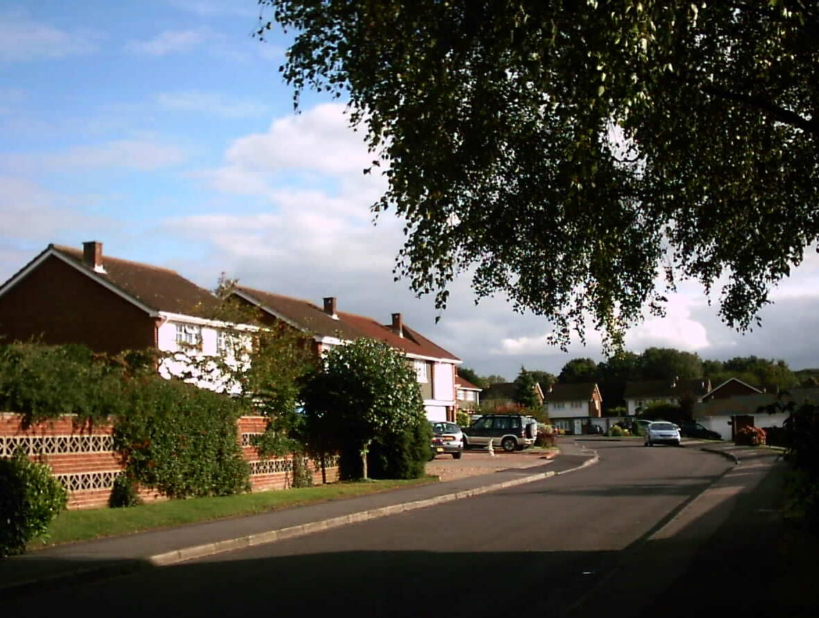
Chantry Avenue, linking Fairby Lane and Ash Road, was one of the last large roads to be built in Hartley (1976), right on the edge of the main built up area.  It is a mixture of large detached houses and bungalows, numbered 1-51 (odd) and 2-66 (even).

In 1969 the owners of "The Stoep" and "Wadsley", on the north side of Fairby Lane applied to develop 4¾ acres of their land.  Just a year before the principle of further development on the southern side of the road had been given a boost by the permission granted on appeal to build numbers 17 and 19, however it did fall in a proposed extension to the Green Belt, which was with the Minister awaiting approval.  The Dartford Rural District Council therefore refused permission because the application was contrary to both the existing district plan and the proposed green belt.  The applicants appealed saying they had too big gardens and the land was "untidy".  They thought private property was not suitable as green belt and promised to protect the views across the Fawkham Valley.  The Minister took into account the existing development of Fairby Lane and agreed it could be an exceptional case, and that design and layout could be used to protect views across the valley.  The photo below shows that to a large extent this has been achieved.

Three years later the developers returned with a plan for 36 houses which was approved, but later additions of land meant that eventually 59 houses were to be built, plus more with Fairby Lane and Ash Road addresses.  The land is divided approximately as follows:

  • 1, 2, 3, 4, 5, 6, 7, 8, 9, 10, 12, 14, 16, 18, 20, 22, 24, 26, 28 (part), 34 (part), 36 (part) - formerly Wadsley, Fairby Lane, a house demolished to make way for the development.  The house itself was where 37 Fairby Lane is today.
  • 11, 13, 28 (part), 30, 32, 34 (part), 36, 38, 40, 42 - formerly part of The Stoep, Fairby Lane.
  • 31 and 44-66 (even) - formerly Ryecroft, Ash Road, a house demolished to make way for the development.  The house itself was named after the field that was here, and was where Galdana, Ash Road is today.
  • 33-51 (odd) - formerly part of Treetops, number 21 Fairby Lane.

Links
Map of road at Multimap.co.uk (also includes link to aerial photo)
Profile of road on www.upmystreet.co.uk
House Prices at Nethouseprices.com