Grange Lane
First published 12.11.2017
About the road
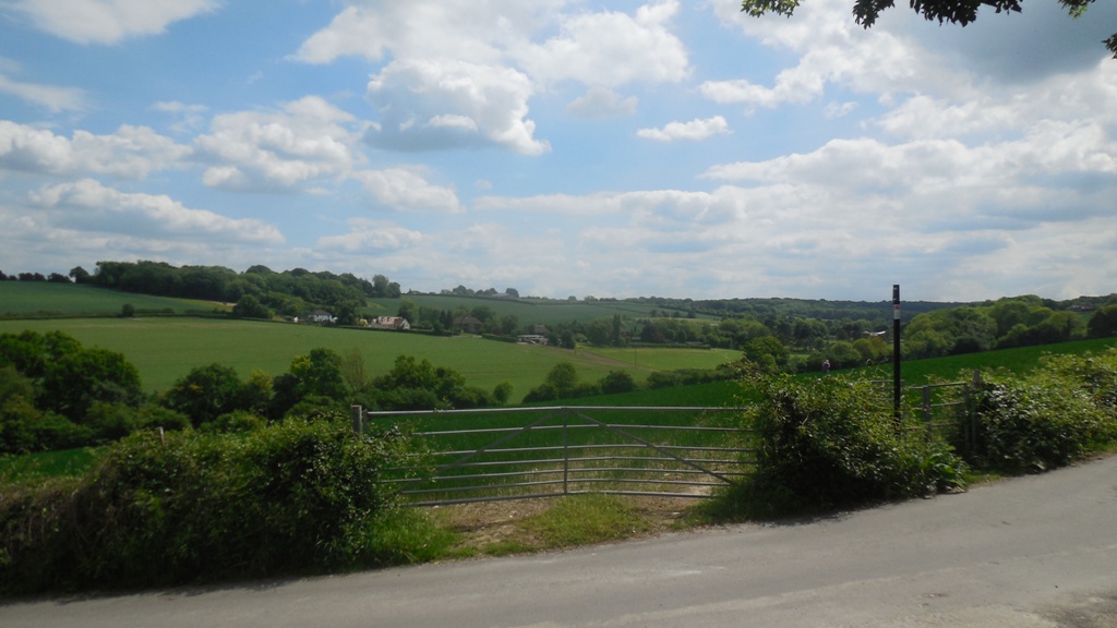
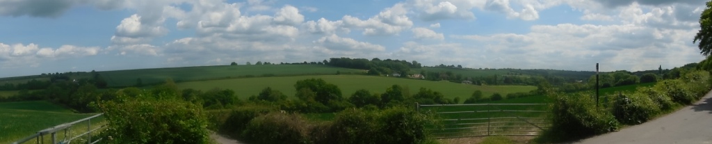
View of Hartley Bottom Valley from Grange Lane
Grange Lane is one of Hartley's most picturesque roads. Descending down the wooded hill from Hartley Church, it takes a sharp left to run round the edge of the ancient woodland of Foxborough Wood (historically pronounced Foxbury). From this part of the road is possibly the best view in Hartley - across the valley of Hartley Bottom. The road then takes a sharp right to the bottom of the valley, before rising on the other side to join Hartley Bottom Road at Red Cow Farm. Grange Lane is mainly surrounded by farmland and woodland. It has only 3 houses.
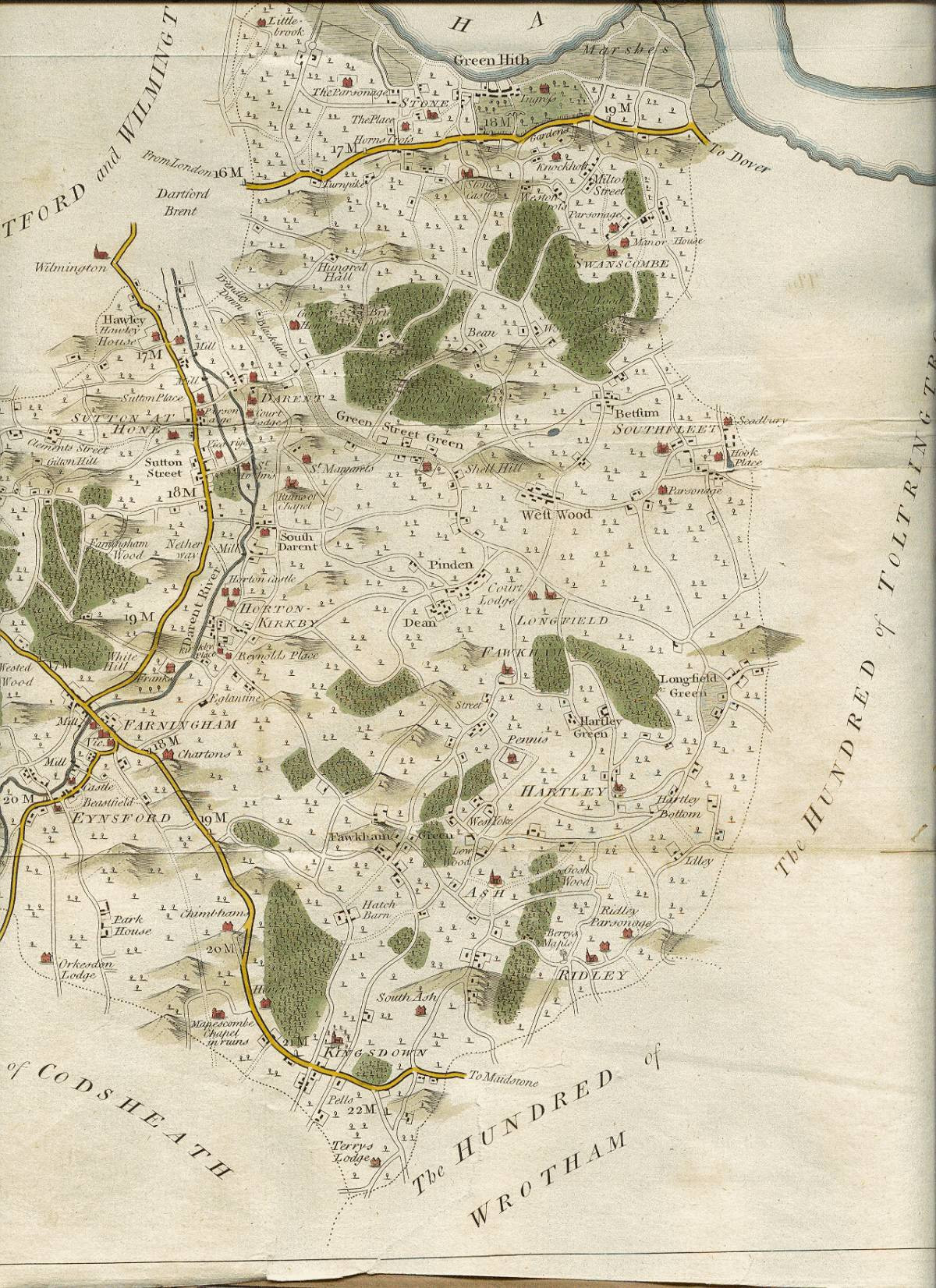
1769 Map showing Grange Lane beside Hartley Church
Grange Lane is of some antiquity. It appears on the earliest map of Hartley in 1769. However the earliest large scale Ordnance Map of 1869 makes it look more like a farm track. Before the war it had many names, including Foxborough Lane, and Red Cow Hill. Dartford Rural District Council finally decided upon Grange Lane, but this was apparently based on a map reading mistake. Its name should be Orange Lane, which is the name of the hill on the other side of the valley which it leads to. In 1929 the road was said to be little used, it had certainly been tarmaced by 1935.
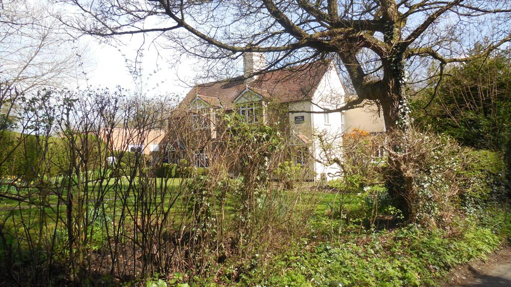
Hartley Court Cottage, built about 1858
The oldest house in Grange Lane is Hartley Court Cottage at the Church Road junction. This first appears in the parish rate book in 1858, so must have been built about then. Small Owners may have split the rest of the parish into smallholdings, but they did little in Grange Lane. Most of the land bordering the road is part of Hartley Bottom Farm. But they did sell two plots of land to become houses. Baptist Minister Alfred Dice built Irene House in about 1918, apparently named after his granddaughter, it is now called Hillside House. This was followed by Hartley Dell in 1933.

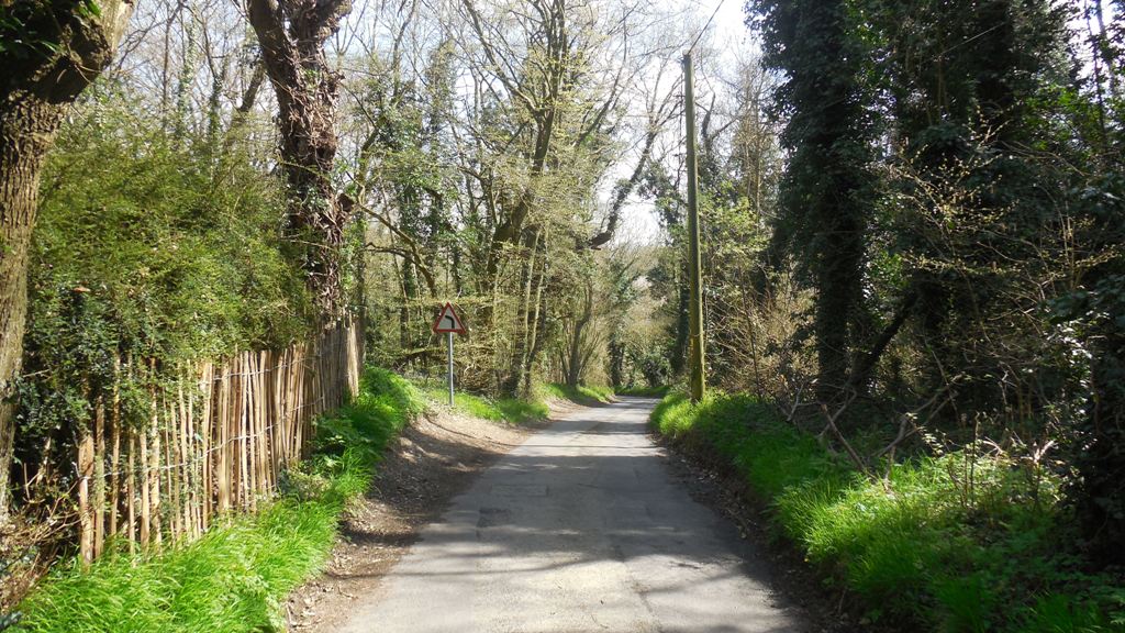
Grange Lane by Foxborough Wood
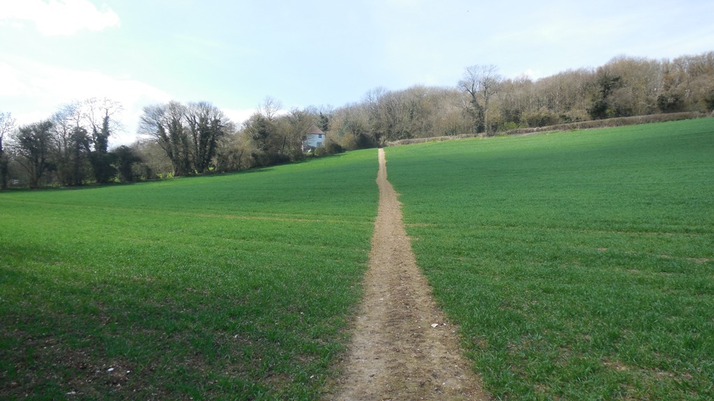
Grange Lane: turning towards the bottom of the valley
Statistics about the road
| Subject | Details |
|---|---|
| Length of Road: | 0.6 miles (959m) |
| KCC Reference: | U1119 (adopted) |
|
Houses/Flats |
3 |
| Population (2011): | 7 |
Information about the houses
Explanation:
Date of Construction is sometimes approximate.
(1) Details of the type of house and the plot history. Plot histories include the ancient farms and fields with the earliest known date, also the
name of the smallholding sold by Smallowners Limited at the beginning of the 20th century.
(2) Planning Permissions include the reference number, so more details can be seen at Sevenoaks Council.
My records are not complete and I have not included refused or withdrawn applications.
(3) Before Council Tax the tax on residential property was called the rates. The registers for 1956, 1963 and 1972 are
held at Sevenoaks Council. The rateable value given is the gross estimated rental value of the property, that is how much
the Valuation Office thought people would pay to rent it, the rates were actually calculated on a lower value after certain
statutory allowances were made. For some reason the 1956 register contains the rateable value for the properties as it would
have been in 1939.
(4) Council tax is based on what the Valuation Office thought the property would have sold for in 1993. It is divided into 8 value bands.
(5) House price data 1995 to date produced by Land Registry © Crown copyright 2016. To report
an error, go to Change a sales record form.
I have tried to make sure the information is accurate, but no responsibility can be taken for any errors. If you plan to rely on the information, you should check the source data to be sure. If you spot an error, please let me know via the contact form.
Grange Lane: section of road from Church Road junction
Hartley Court Cottage, Grange Lane, DA3 8DY
Built: 1858
(2) Planning Permission: 1925/Meeting 1925-08-04 Extension of stairs
(2) Planning Permission: 1938/2873 Addition to building
(2) Planning Permission: 1970/503 2 storey rear extension
(3) Rateable Value (1956): £44
(3) Rateable Value (1963): £106
(3) Rateable Value (1972): £395
(4) Council Tax (1993): Band G (£160-320K)
Hillside House, Grange Lane, DA3 8LH
Built: 1918
(1) Former House Name: Irene House (1918 - 1956)
(3) Rateable Value (1956): £35
(3) Rateable Value (1963): £90
(3) Rateable Value (1972): £217
(4) Council Tax (1993): Band G (£160-320K)
(5) Marketed (31 Aug 1922): £1,150
Grange Lane: View from the valley and Hillside House
The Dell, Grange Lane, DA3 8LH
Built: 1933
(2) Planning Permission: 1933/Meeting 1933-08-01 Brick Bungalow (Hartley Hill)
(2) Planning Permission: 1973/Meeting Jul 73 Construct bedrooms in roof space
(3) Rateable Value (1956): £28
(3) Rateable Value (1963): £72
(3) Rateable Value (1972): £432
(4) Council Tax (1993): Band G (£160-320K)
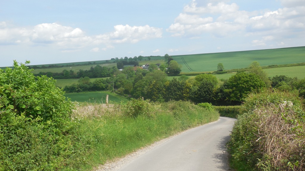
Grange Lane: Hartley Bottom from Grange Lane