St John's Lane, Grange Way, Billings Hill Shaw
About the road
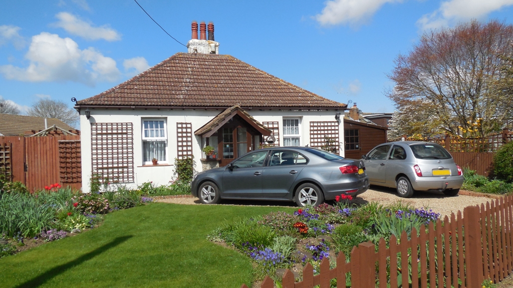
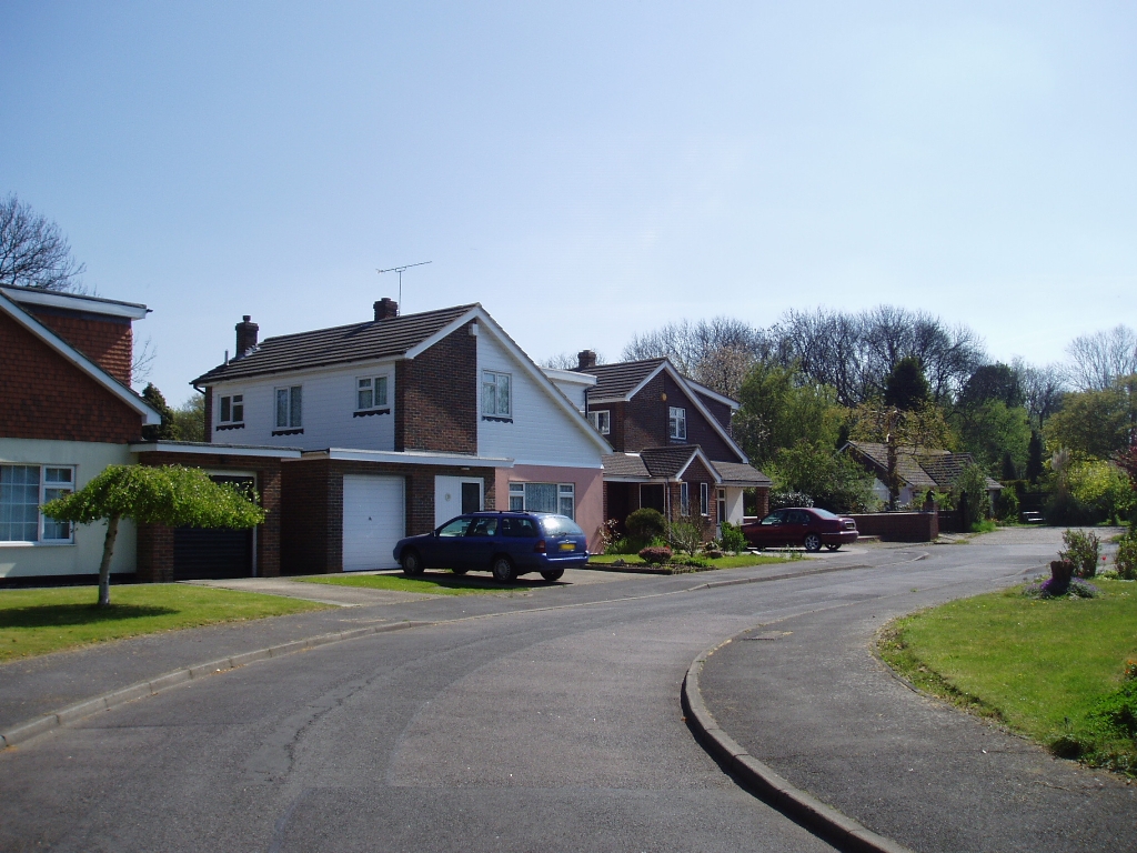
Orchard Cottage, St John's Lane
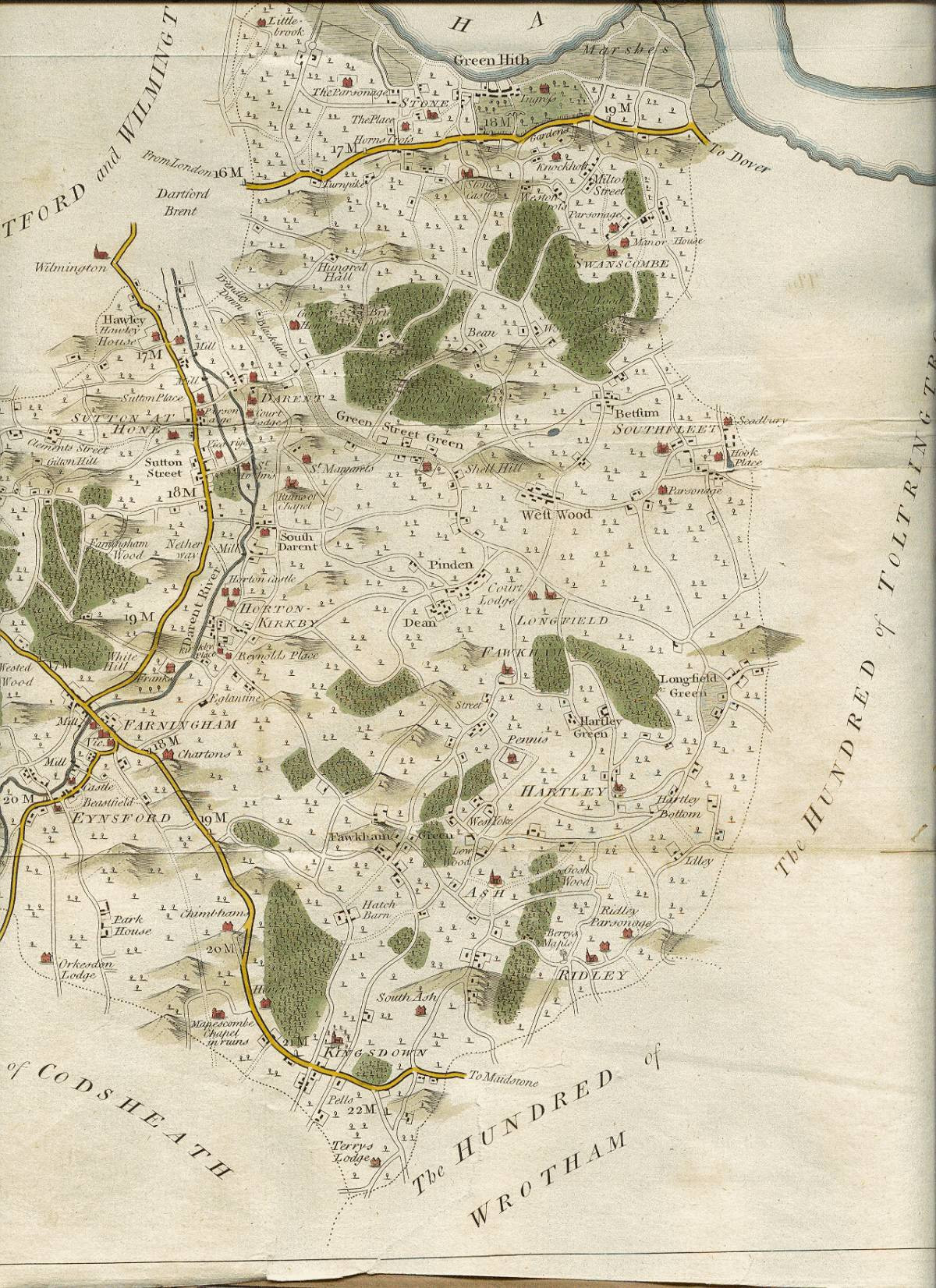
St John's Lane (often pronounced "sinjins lane" locally), is one of Hartley's ancient roads, linking Church Road and Ash Road. It is shown on the 1769 map of the area. It has two Smallowners built houses dating to the early 20th century (Glebe House and Orchard Cottage), but the remaining houses date to the 1960s and 1970s. The road was originally named, but is now numbered.
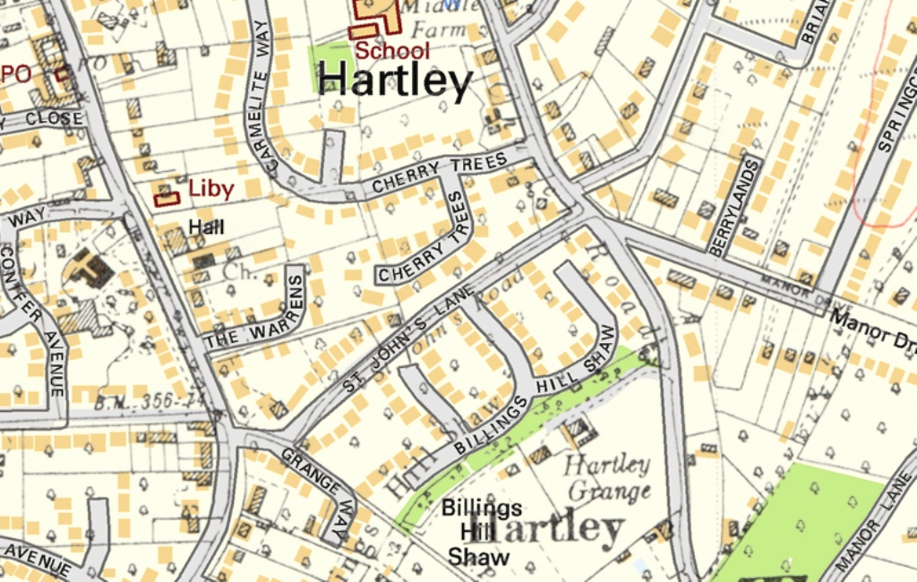
Hartley-Kent: St John's Lane 1936 map (houses black and hatched) overlaid on the modern map
(houses in brown)
The origin of the name is unclear, as there are no obvious links in Hartley to St John, the Church for example is dedicated to All Saints' and the field names do not provide any clue. We are also hampered by a lack of pre-20th century references to the name of the road. Before the war it was called both St John's Road and St John's Lane, but residents were definitely unhappy when the council put up a St John's Road sign in 1967.
Up until the late 1960s the road was very narrow and difficult to pass, which acted as a block to further development as well as being inconvenient for travellers. In 1923 Hartley parish asked for the road to be widened. This led to the widening of the Ash Road junction and the erection of a sign saying it was unsuitable for heavy traffic. In 1936 Hartley's district councillor, Captain Bignell, called again for widening. Dartford Rural Council didn't want to pay for this, but decided to negotiate for the purchase of land for two passing places. Meanwhile Hartley Grange came up for sale and Mr and Mrs Hoath the new owners offered land for road widening in 1938. This time the problem was Kent County Council who objected to the scheme on grounds of the £1,388 cost. Dartford RDC replied that they believed the road was narrow and dangerous, being only 8 feet wide in places. So back it was to the plan for two passing places which would cost £147, but by now the landowner was getting impatient at the council's constant delays. Nothing had been done in the war years, and in 1949 the parish council was reduced to asking for one-way traffic, this seems to have led to the passing places being added the following year. Widening was finally achieved in 1969.
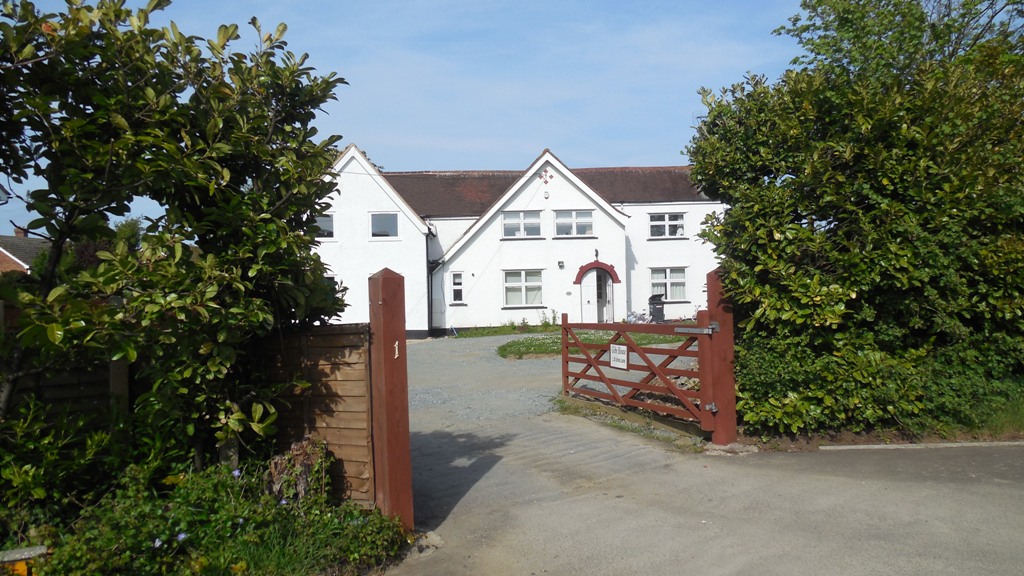
Glebe House, oldest house in St John's Lane
The earliest house was Glebe House (number 1) which was called Bundoran when built in 1912. Orchard Cottage (number 19) was built on part of the plot in 1921. The 1958 Town Plan envisaged infilling on the north side of St John's Lane within the following 5 years, but placed the south side (including the site of Billings Hill Shaw and Grange Way) in the "white land" where they did not want to allow development for at least 20 years. From 1942 to 1968 number 1 was the home of the Rectors of Hartley Church, then numbers 3-15 were built on the back garden of Glebe House by Fovn Construction Co Limited, and number 3 became the new Rectory and remains so today. Of the other odd numbers 17 was built in part of the garden of Orchard Cottage; and nd 21-25 were built by Brewster Estates Limited on land that was Cherry Orchard Farm. The house itself was where the back gardens of 23 and 25 are today.The even numbers were built at the same time as Billings Hill Shaw on land that had belonged to Hartley Grange by George Wimpey & Co Ltd.
Going further back in time, St John's Lane was bordered by no less than three farms - Fairby, Blue House Farm and Middle Farm (see map).
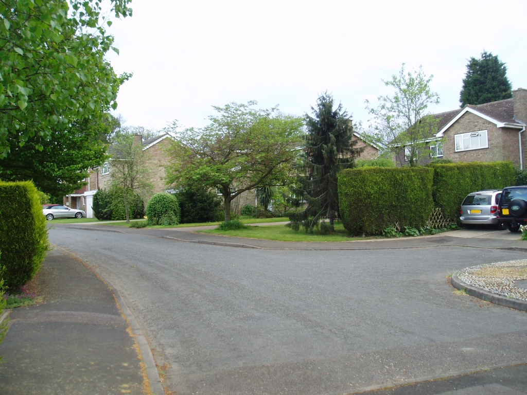
Grange Way
Grange Way is a small cul-de-sac of mostly detached bungalows. It was built in 1967-8 by the firm A P Clifford Limited of St Mary Cray. The land for it was part of the back garden of Amphion (now called Avalon), Ash Road, which the owners (John and Gynneth Tate) sold for £13,500 on 5 July 1966. Previously Mr Tate had got planning permission for 5 houses and 4 bungalows (Ref: TH/58/396; TH/64/1C). The Tates had owned the land since buying it from Smallowners Limited in 1915. Southside and May Cottage are later additions. They were built at the same time as Tates Orchard on the back garden of Brendon, Ash Road.
The status of road numbering for Grange Way is a bit uncertain. According to the Post Office website only 2, 4, 5 and 7 have numbers and the others are names without numbers. However all but Southside and May Cottage are numbered on the Ordnance Survey map.

44-50 Billings Hill Shaw
Billings Hill Shaw historically is the name of strip of woodland at the southern end of the estate. Shaws were often historic estate boundaries, and indeed this marked the edge of the Hartley Court estate. The origin of the name is uncertain. In other place names Billing is normally a personal name. It is not connected with the Billings family, who have built many of Hartley's modern houses.
When Smallowners Limited broke up the old farms into smallholdings, this area became the holding called "Hill Shaw", later "Hartley Grange". It's future development potential was recognised as early as 1937 in its advert for sale in the Guardian.
"Hartley Grange, Longfield, Kent, is a modern house, built, int he favourite way, in two stories. Its particular attractions are two fold. In the first place, it is a very compact and easily run small country property in an exceedingly pleasant part of Kent and one which is noted for its fruit growing. Ten out of its 16 acres produce apples, pears, plums and cherries on the 2,000 trees, everyone full bearing, with which they are planted. It is just the sort of place to suit anyone who wants to live a country life with sufficient land to indulge a profitable hobby, like fruit farming or poultry rearing. Then there is the other side to it. There are road frontages to the property which are of considerable potential value. The 835 feet to Church Road and the 1,040 to St John's Road, both parish roads with no paving charges, would make it worth while considering whether the Grange was not an attractive proposition from the developer's point of view. London is within an hour's journey by the best trains. Harrods are the agents concerned, and they will sell the property publicly on September 7 if nobody buys it before then."
The buyers in 1937 were (Ralph) Stanley Hoath and Doris Viney Hoath. They were from farming families and had previously lived at Greycote in Manor Drive. In 1931 Mr Hoath was living at Littlebrook Manor in Dartford, so may have had to move when the land was acquired for the power station there. As they approached retirement age in 1961 they considered developing Billings Hill Shaw. Mr and Mrs Hoath were told not yet, although it was clearly envisaged the site would one day be developed. 1958 town plan had earmarked the land as a potential site for the new Hartley Primary School which eventually went to Round Ash Way. In 1968 Mrs Hoath signed an agreement to sell with the builders George Wimpey. In the same year another attempt was made to develop the site. This went to appeal; the planning inspector said the 5 acres of the future Billings Hill Shaw was acceptable for development, but the rest of Hartley Grange was not. Finally in 1973 George Wimpey got the green light and three years later, Billings Hill Shaw came into being. As part of the planning permission part of the land was transferred to the parish council to become a recreation ground, largely used by dog walkers today. However it does contain a faint echo of the old smallholding, because a few of the orchard trees were retained. It is uncertain whether the builders realised that they had also conveyed Hartley Grange Cottage with the land, but for many years the parish council let it out to tenants. They originally didn't want to sell the cottage because they thought they might need it one day for a groundsman, but eventually sold it in 1995.
Statistics about the road
| Subject | Details |
|---|---|
| Length of Road: | |
| KCC Reference: | St John's Lane U1123 Unclassified single carriageway 0.23 miles (365 metres)
Billings Hill Shaw U14735 Unclassified single carriageway 0.31 miles (493 metres) Grange Way U12965 Unclassified single carriageway 0.07 miles (115 metres) |
| Acreage: | St John's Lane 2.89 acres (1.17 ha) Billings Hill Shaw 6.35 acres (2.57 ha) Grange Way 1.75 acres (0.71 ha) |
|
Houses/Flats |
St John's Lane 22 Billings Hill Shaw 47 Grange Way 9 |
| Density: | St John's Lane 7.6 houses/acre (18.8 houses/ha) Billings Hill Shaw 7.4 houses/acre (18.3 houses/ha) Grange Way 5.1 houses/acre (12.7 houses/ha) Hartley average 4.9 houses/acre) |
| Population (2011): | St John's Lane 59 Billings Hill Shaw 105 Grange Way 21 |
| Companies with registered address here (2013): | St John's Lane 0 Billings Hill Shaw 2 Grange Way 1 |
Information about the houses
Explanation:
Date of Construction is sometimes approximate.
(1) Details of the type of house and the plot history. Plot histories include the ancient farms and fields with the earliest known date, also the
name of the smallholding sold by Smallowners Limited at the beginning of the 20th century.
(2) Planning Permissions include the reference number, so more details can be seen at Sevenoaks Council.
My records are not complete and I have not included refused or withdrawn applications.
(3) Before Council Tax the tax on residential property was called the rates. The registers for 1956, 1963 and 1972 are
held at Sevenoaks Council. The rateable value given is the gross estimated rental value of the property, that is how much
the Valuation Office thought people would pay to rent it, the rates were actually calculated on a lower value after certain
statutory allowances were made. For some reason the 1956 register contains the rateable value for the properties as it would
have been in 1939.
(4) Council tax is based on what the Valuation Office thought the property would have sold for in 1993. It is divided into 8 value bands.
(5) House price data 1995 to date produced by Land Registry © Crown copyright 2016. To report
an error, go to Change a sales record form.
I have tried to make sure the information is accurate, but no responsibility can be taken for any errors. If you plan to rely on the information, you should check the source data to be sure. If you spot an error, please let me know via the contact form.
Billings Hill Shaw
1 Billings Hill Shaw, DA3 8EU
Built: 1976
(1) Property Type: Detached house
(1) Plot History: Haydings (Middle Farm) (1624)
(1) Plot History: Hartley Grange, Church Road (1920)
(2) Planning Permission: 1973/134 Development by George Wimpey & Co
(4) Council Tax (1993): Band F (£120-160K)
2 Billings Hill Shaw, DA3 8EU
Built: 1976
(1) Property Type: Detached house
(1) Plot History: Haydings (Middle Farm) (1624)
(1) Plot History: Hartley Grange, Church Road (1920)
(2) Planning Permission: 1973/134 Development by George Wimpey & Co
(4) Council Tax (1993): Band F (£120-160K)
(5) Sale (19 Jun 1996): £138,000
3 Billings Hill Shaw, DA3 8EU
Built: 1976
(1) Property Type: Detached house
(1) Plot History: Haydings (Middle Farm) (1624)
(1) Plot History: Hartley Grange, Church Road (1920)
(2) Planning Permission: 1973/134 Development by George Wimpey & Co
(4) Council Tax (1993): Band F (£120-160K)
4 Billings Hill Shaw, DA3 8EU
Built: 1976
(1) Property Type: Detached house
(1) Plot History: Haydings (Middle Farm) (1624)
(1) Plot History: Hartley Grange, Church Road (1920)
(2) Planning Permission: 1973/134 Development by George Wimpey & Co
(4) Council Tax (1993): Band F (£120-160K)
5 Billings Hill Shaw, DA3 8EU
Built: 1976
(1) Property Type: Detached house
(1) Plot History: Haydings (Middle Farm) (1624)
(1) Plot History: Hartley Grange, Church Road (1920)
(2) Planning Permission: 1973/134 Development by George Wimpey & Co
(4) Council Tax (1993): Band F (£120-160K)
6 Billings Hill Shaw, DA3 8EU
Built: 1976
(1) Property Type: Detached house
(1) Plot History: Haydings (Middle Farm) (1624)
(1) Plot History: Hartley Grange, Church Road (1920)
(2) Planning Permission: 1973/134 Development by George Wimpey & Co
(4) Council Tax (1993): Band F (£120-160K)
(5) Sale (1 Mar 1977): £24,650
(5) Sale (10 May 1996): £95,000
(5) Sale (25 Oct 2013): £400,000
7 Billings Hill Shaw, DA3 8EU
Built: 1976
(1) Property Type: Detached house
(1) Plot History: Haydings (Middle Farm) (1624)
(1) Plot History: Hartley Grange, Church Road (1920)
(2) Planning Permission: 1973/134 Development by George Wimpey & Co
(4) Council Tax (1993): Band F (£120-160K)
8 Billings Hill Shaw, DA3 8EU
Built: 1976
(1) Property Type: Detached house
(1) Plot History: Haydings (Middle Farm) (1624)
(1) Plot History: Hartley Grange, Church Road (1920)
(2) Planning Permission: 1973/134 Development by George Wimpey & Co
(2) Planning Permission: 2010/737 Convert flat roof over garage to pitched roof
(4) Council Tax (1993): Band F (£120-160K)
(5) Sale (7 Nov 2006): £378,000
9 Billings Hill Shaw, DA3 8EU
Built: 1976
(1) Property Type: Detached house
(1) Plot History: Haydings (Middle Farm) (1624)
(1) Plot History: Hartley Grange, Church Road (1920)
(2) Planning Permission: 1973/134 Development by George Wimpey & Co
(2) Planning Permission: 1987/926 Extension
(4) Council Tax (1993): Band F (£120-160K)
10 Billings Hill Shaw, DA3 8EU
Built: 1976
(1) Property Type: Detached house (5 bedrooms)
(1) Plot History: Haydings (Middle Farm) (1624)
(1) Plot History: Hartley Grange, Church Road (1920)
(2) Planning Permission: 1973/134 Development by George Wimpey & Co
(2) Planning Permission: 1999/1102 1st floor and 2 storey side extension
(4) Council Tax (1993): Band F (£120-160K)
(5) Sale (15 Dec 1995): £140,000
(5) Sale (12 Aug 2011): £435,000
11 Billings Hill Shaw, DA3 8EU
Built: 1976
(1) Property Type: Detached house
(1) Plot History: Haydings (Middle Farm) (1624)
(1) Plot History: Hartley Grange, Church Road (1920)
(2) Planning Permission: 1973/134 Development by George Wimpey & Co
(4) Council Tax (1993): Band F (£120-160K)
(5) Sale (22 Sep 1997): £135,000
(5) Sale (9 Oct 2006): £356,000
12 Billings Hill Shaw, DA3 8EU
Built: 1976
(1) Additional or Former House Name: VEPS (Business) (2015)
(1) Property Type: Detached house
(1) Plot History: Haydings (Middle Farm) (1624)
(1) Plot History: Hartley Grange, Church Road (1920)
(2) Planning Permission: 1973/134 Development by George Wimpey & Co
(4) Council Tax (1993): Band F (£120-160K)
13 Billings Hill Shaw, DA3 8EU
Built: 1976
(1) Property Type: Detached house
(1) Plot History: Haydings (Middle Farm) (1624)
(1) Plot History: Hartley Grange, Church Road (1920)
(2) Planning Permission: 1973/134 Development by George Wimpey & Co
(4) Council Tax (1993): Band F (£120-160K)
(5) Sale (15 Jun 1997): £149,000
14 Billings Hill Shaw, DA3 8EU
Built: 1976
(1) Property Type: Detached house
(1) Plot History: Haydings (Middle Farm) (1624)
(1) Plot History: Hartley Grange, Church Road (1920)
(2) Planning Permission: 1973/134 Development by George Wimpey & Co
(4) Council Tax (1993): Band F (£120-160K)
(5) Sale (19 Nov 2015): £360,000
15 Billings Hill Shaw, DA3 8EU
Built: 1976
(1) Property Type: Detached house
(1) Plot History: Haydings (Middle Farm) (1624)
(1) Plot History: Hartley Grange, Church Road (1920)
(2) Planning Permission: 1973/134 Development by George Wimpey & Co
(2) Planning Permission: 2000/1823 Extension to garage
(4) Council Tax (1993): Band F (£120-160K)
16 Billings Hill Shaw, DA3 8EU
Built: 1976
(1) Property Type: Detached house
(1) Plot History: Haydings (Middle Farm) (1624)
(1) Plot History: Hartley Grange, Church Road (1920)
(2) Planning Permission: 1973/134 Development by George Wimpey & Co
(2) Planning Permission: 2001/973 Front extension to garage and new porch
(4) Council Tax (1993): Band F (£120-160K)
17 Billings Hill Shaw, DA3 8EU
Built: 1976
(1) Property Type: Detached house
(1) Plot History: Haydings (Middle Farm) (1624)
(1) Plot History: Hartley Grange, Church Road (1920)
(2) Planning Permission: 1973/134 Development by George Wimpey & Co
(4) Council Tax (1993): Band F (£120-160K)
18 Billings Hill Shaw, DA3 8EU
Built: 1976
(1) Additional or Former House Name: Birchley (2015)
(1) Property Type: Detached house
(1) Plot History: Haydings (Middle Farm) (1624)
(1) Plot History: Hartley Grange, Church Road (1920)
(2) Planning Permission: 1973/134 Development by George Wimpey & Co
(2) Planning Permission: 1989/2119 Extension
(2) Planning Permission: 2000/1675 Single storey side extension
(4) Council Tax (1993): Band F (£120-160K)
19 Billings Hill Shaw, DA3 8EU
Built: 1976
(1) Property Type: Detached house
(1) Plot History: Haydings (Middle Farm) (1624)
(1) Plot History: Hartley Grange, Church Road (1920)
(2) Planning Permission: 1973/134 Development by George Wimpey & Co
(4) Council Tax (1993): Band F (£120-160K)
(5) Sale (1 Feb 2013): £422,500
20 Billings Hill Shaw, DA3 8EU
Built: 1976
(1) Property Type: Detached house
(1) Plot History: Haydings (Middle Farm) (1624)
(1) Plot History: Hartley Grange, Church Road (1920)
(2) Planning Permission: 1973/134 Development by George Wimpey & Co
(4) Council Tax (1993): Band F (£120-160K)
21 Billings Hill Shaw, DA3 8EU
Built: 1976
(1) Property Type: Detached house (4 bedrooms)
(1) Plot History: Haydings (Middle Farm) (1624)
(1) Plot History: Hartley Grange, Church Road (1920)
(2) Planning Permission: 1973/134 Development by George Wimpey & Co
(2) Planning Permission: 1994/1546 Convert garage to living accommodation
(4) Council Tax (1993): Band F (£120-160K)
(5) Sale (31 Jan 2012): £374,000
22 Billings Hill Shaw, DA3 8EU
Built: 1976
(1) Property Type: Detached house
(1) Plot History: Haydings (Middle Farm) (1624)
(1) Plot History: Hartley Grange, Church Road (1920)
(2) Planning Permission: 1973/134 Development by George Wimpey & Co
(4) Council Tax (1993): Band F (£120-160K)
23 Billings Hill Shaw, DA3 8EU
Built: 1976
(1) Property Type: Detached house (4 bedrooms)
(1) Plot History: Haydings (Middle Farm) (1624)
(1) Plot History: Hartley Grange, Church Road (1920)
(2) Planning Permission: 1973/134 Development by George Wimpey & Co
(4) Council Tax (1993): Band F (£120-160K)
(5) Sale (12 May 1995): £128,000
(5) Sale (10 Apr 2000): £196,000
(5) Sale (28 Jul 2008): £368,000
(5) Sale (2 Jun 2011): £367,500
24 Billings Hill Shaw, DA3 8EU
Built: 1976
(1) Property Type: Detached house
(1) Plot History: Haydings (Middle Farm) (1624)
(1) Plot History: Hartley Grange, Church Road (1920)
(2) Planning Permission: 1973/134 Development by George Wimpey & Co
(2) Planning Permission: 2011/2809 1st floor front extension
(4) Council Tax (1993): Band G (£160-320K)
25 Billings Hill Shaw, DA3 8EU
Built: 1976
(1) Property Type: Detached house
(1) Plot History: Haydings (Middle Farm) (1624)
(1) Plot History: Hartley Grange, Church Road (1920)
(2) Planning Permission: 1973/134 Development by George Wimpey & Co
(4) Council Tax (1993): Band F (£120-160K)
26 Billings Hill Shaw, DA3 8EU
Built: 1976
(1) Property Type: Detached house
(1) Plot History: Haydings (Middle Farm) (1624)
(1) Plot History: Hartley Grange, Church Road (1920)
(2) Planning Permission: 1973/134 Development by George Wimpey & Co
(2) Planning Permission: 1998/51 Pitched roof to garage
(4) Council Tax (1993): Band F (£120-160K)
27 Billings Hill Shaw, DA3 8EU
Built: 1976
(1) Property Type: Detached house
(1) Plot History: Haydings (Middle Farm) (1624)
(1) Plot History: Hartley Grange, Church Road (1920)
(2) Planning Permission: 1973/134 Development by George Wimpey & Co
(4) Council Tax (1993): Band F (£120-160K)
28 Billings Hill Shaw, DA3 8EU
Built: 1976
(1) Property Type: Detached house
(1) Plot History: Haydings (Middle Farm) (1624)
(1) Plot History: Hartley Grange, Church Road (1920)
(2) Planning Permission: 1973/134 Development by George Wimpey & Co
(4) Council Tax (1993): Band F (£120-160K)
29 Billings Hill Shaw, DA3 8EU
Built: 1976
(1) Property Type: Detached house
(1) Plot History: Haydings (Middle Farm) (1624)
(1) Plot History: Hartley Grange, Church Road (1920)
(2) Planning Permission: 1973/134 Development by George Wimpey & Co
(2) Planning Permission: 2006/2720 Replacement porch, new roof over garage
(2) Planning Permission: 2014/257 Front porch extension
(4) Council Tax (1993): Band F (£120-160K)
30 Billings Hill Shaw, DA3 8EU
Built: 1976
(1) Property Type: Detached house
(1) Plot History: Parrys Croft (Fairby Farm) (1604)
(1) Plot History: Hartley Grange, Church Road (1920)
(2) Planning Permission: 1973/134 Development by George Wimpey & Co
(4) Council Tax (1993): Band F (£120-160K)
31 Billings Hill Shaw, DA3 8EU
Built: 1976
(1) Property Type: Detached house
(1) Plot History: Haydings (Middle Farm) (1624)
(1) Plot History: Hartley Grange, Church Road (1920)
(2) Planning Permission: 1973/134 Development by George Wimpey & Co
(2) Planning Permission: 2015/3664 Demolition of existing front study and erection of single storey front and side extension with shallow pitched roof incorporating Velux window and internal en-suite, together with porch enclosure to front entrance
(4) Council Tax (1993): Band F (£120-160K)
(5) Sale (4 May 1995): £111,000
(5) Sale (2 Feb 2007): £365,000
32 Billings Hill Shaw, DA3 8EU
Built: 1976
(1) Property Type: Detached house
(1) Plot History: Parrys Croft (Fairby Farm) (1604)
(1) Plot History: Hartley Grange, Church Road (1920)
(2) Planning Permission: 1973/134 Development by George Wimpey & Co
(2) Planning Permission: 2010/2471 Single storey side extension
(4) Council Tax (1993): Band F (£120-160K)
(5) Sale (15 Jan 1999): £183,000
(5) Sale (29 Aug 2006): £381,250
33 Billings Hill Shaw, DA3 8EU
Built: 1976
(1) Property Type: Detached house
(1) Plot History: Haydings (Middle Farm) (1624)
(1) Plot History: Hartley Grange, Church Road (1920)
(2) Planning Permission: 1973/134 Development by George Wimpey & Co
(4) Council Tax (1993): Band F (£120-160K)
34 Billings Hill Shaw, DA3 8EU
Built: 1976
(1) Property Type: Detached house
(1) Plot History: Parrys Croft (Fairby Farm) (1604)
(1) Plot History: Hartley Grange, Church Road (1920)
(2) Planning Permission: 1973/134 Development by George Wimpey & Co
(4) Council Tax (1993): Band F (£120-160K)
35 Billings Hill Shaw, DA3 8EU
Built: 1976
(1) Property Type: Detached house
(1) Plot History: Haydings (Middle Farm) (1624)
(1) Plot History: Hartley Grange, Church Road (1920)
(2) Planning Permission: 1973/134 Development by George Wimpey & Co
(4) Council Tax (1993): Band F (£120-160K)
(5) Sale (12 Feb 2004): £315,000
36 Billings Hill Shaw, DA3 8EU
Built: 1976
(1) Property Type: Detached house
(1) Plot History: Parrys Croft (Fairby Farm) (1604)
(1) Plot History: Hartley Grange, Church Road (1920)
(2) Planning Permission: 1973/134 Development by George Wimpey & Co
(2) Planning Permission: 1984/1504 Dining room and snooker room
(2) Planning Permission: 2011/723 Erection of first floor front extension
(4) Council Tax (1993): Band G (£160-320K)
37 Billings Hill Shaw, DA3 8EU
Built: 1976
(1) Property Type: Detached house
(1) Plot History: Haydings (Middle Farm) (1624)
(1) Plot History: Hartley Grange, Church Road (1920)
(2) Planning Permission: 1973/134 Development by George Wimpey & Co
(4) Council Tax (1993): Band F (£120-160K)
38 Billings Hill Shaw, DA3 8EU
Built: 1976
(1) Property Type: Detached house
(1) Plot History: Parrys Croft (Fairby Farm) (1604)
(1) Plot History: Hartley Grange, Church Road (1920)
(2) Planning Permission: 1973/134 Development by George Wimpey & Co
(4) Council Tax (1993): Band F (£120-160K)
39 Billings Hill Shaw, DA3 8EU
Built: 1976
(1) Property Type: Detached house
(1) Plot History: Haydings (Middle Farm) (1624)
(1) Plot History: Hartley Grange, Church Road (1920)
(2) Planning Permission: 1973/134 Development by George Wimpey & Co
(2) Planning Permission: 1986/2173 Erect 6 foot fence
(4) Council Tax (1993): Band F (£120-160K)
40 Billings Hill Shaw, DA3 8EU
Built: 1976
(1) Property Type: Detached house
(1) Plot History: Parrys Croft (Fairby Farm) (1604)
(1) Plot History: Hartley Grange, Church Road (1920)
(2) Planning Permission: 1973/134 Development by George Wimpey & Co
(2) Planning Permission: 2005/1719 Boundary Wall
(4) Council Tax (1993): Band F (£120-160K)
(5) Sale (5 Nov 2004): £350,000
(5) Sale (24 Apr 2015): £470,000
41 Billings Hill Shaw, DA3 8EU
Built: 1976
(1) Property Type: Detached house
(1) Plot History: Haydings (Middle Farm) (1624)
(1) Plot History: Hartley Grange, Church Road (1920)
(2) Planning Permission: 1973/134 Development by George Wimpey & Co
(2) Planning Permission: 1985/1547 Erect 6 feet high close boarded fence on side boundary
(4) Council Tax (1993): Band F (£120-160K)
42 Billings Hill Shaw, DA3 8EU
Built: 1976
(1) Property Type: Detached house
(1) Plot History: Parrys Croft (Fairby Farm) (1604)
(1) Plot History: Hartley Grange, Church Road (1920)
(2) Planning Permission: 1973/134 Development by George Wimpey & Co
(4) Council Tax (1993): Band F (£120-160K)
(4) Council Tax (1993): Band G (£ExK)
(5) Sale (23 Oct 1998): £185,000
43 Billings Hill Shaw, DA3 8EU
Built: 1976
(1) Property Type: Detached house
(1) Plot History: Parrys Croft (Fairby Farm) (1604)
(1) Plot History: Hartley Grange, Church Road (1920)
(2) Planning Permission: 1973/134 Development by George Wimpey & Co
(4) Council Tax (1993): Band F (£120-160K)
44 Billings Hill Shaw, DA3 8EU
Built: 1976
(1) Property Type: Detached house (5 bedrooms)
(1) Plot History: Parrys Croft (Fairby Farm) (1604)
(1) Plot History: Hartley Grange, Church Road (1920)
(2) Planning Permission: 1973/134 Development by George Wimpey & Co
(4) Council Tax (1993): Band G (£160-320K)
(5) Sale (0 Jan 1900): £
46 Billings Hill Shaw, DA3 8EU
Built: 1976
(1) Property Type: Detached house
(1) Plot History: Parrys Croft (Fairby Farm) (1604)
(1) Plot History: Hartley Grange, Church Road (1920)
(2) Planning Permission: 1973/134 Development by George Wimpey & Co
(4) Council Tax (1993): Band F (£120-160K)
48 Billings Hill Shaw, DA3 8EU
Built: 1976
(1) Property Type: Detached house
(1) Plot History: Parrys Croft (Fairby Farm) (1604)
(1) Plot History: Hartley Grange, Church Road (1920)
(2) Planning Permission: 1973/134 Development by George Wimpey & Co
(4) Council Tax (1993): Band F (£120-160K)
50 Billings Hill Shaw, DA3 8EU
Built: 1976
(1) Property Type: Detached house (5 bedrooms)
(1) Plot History: Parrys Croft (Fairby Farm) (1604)
(1) Plot History: Hartley Grange, Church Road (1920)
(2) Planning Permission: 1973/134 Development by George Wimpey & Co
(4) Council Tax (1993): Band G (£160-320K)
(5) Sale (0 Jan 1900): £
Hartley Grange Cottage Billings Hill Shaw, DA3 8EU
Built: 1926
(1) Property Type: Detached bungalow
(1) Plot History: West Field (Hartley Court) (1844)
(1) Plot History: Hartley Grange, Church Road (1920)
(2) Planning Permission: 1926/Meeting 1926-07-06 Timber framed bungalow with expanded metal lathing and cement roughcasted
(3) Rateable Value (1956): £28
(3) Rateable Value (1963): £78
(3) Rateable Value (1972): £175
(4) Council Tax (1993): Band E (£88-120K)
(5) Sale (10 Jul 1995): £78,000
3 Grange Way, DA3 8ES
Built: 1970
(1) Property Type: Detached house
(1) Plot History: Parrys Croft (Fairby Farm) (1604)
(1) Plot History: Amphion (Avalon), Ash Road (1915)
(2) Planning Permission: 1975/268 single storey kitchen extension at rear
(3) Rateable Value (1972): £330
(4) Council Tax (1993): Band F (£120-160K)
2 Grange Way, DA3 8ES
Built: 1970
(1) Property Type: Detached house (5 bedrooms)
(1) Plot History: Parrys Croft (Fairby Farm) (1604)
(1) Plot History: Amphion (Avalon), Ash Road (1915)
(2) Planning Permission: 2009/205 2 storey side extension
(2) Planning Permission: 2016/2743 Single Storey rear extension.
(3) Rateable Value (1972): £330
(4) Council Tax (1993): Band F (£120-160K)
(5) Sale (8 Jan 1997): £126,000
(5) Sale (7 Nov 2014): £487,500
1 Grange Way, DA3 8ES
Built: 1970
(1) Property Type: Detached house
(1) Plot History: Parrys Croft (Fairby Farm) (1604)
(1) Plot History: Amphion (Avalon), Ash Road (1915)
(3) Rateable Value (1972): £336
(4) Council Tax (1993): Band F (£120-160K)
Southside Grange Way, DA3 8ES
Built: 1984
(1) Property Type: Detached bungalow (3 bedrooms)
(1) Plot History: Parrys Croft (Fairby Farm) (1604)
(1) Plot History: Amphion (Avalon), Ash Road (1915)
(3) Rateable Value (1972): £269
(4) Council Tax (1993): Band E (£88-120K)
(5) Sale (18 Jun 2010): £280,000
8 Grange Way, DA3 8ES
Built: 1967
(1) Property Type: Detached house
(1) Plot History: Parrys Croft (Fairby Farm) (1604)
(1) Plot History: Amphion (Avalon), Ash Road (1915)
(3) Rateable Value (1972): £334
(4) Council Tax (1993): Band F (£120-160K)
(5) Marketed (7 Jan 2016): £425,000
(5) Sale (5 Oct 2012): £310,000
7 Grange Way, DA3 8ES
Built: 1968
(1) Additional or Former House Name: Brindles (2015)
(1) Property Type: Detached bungalow (3 bedrooms)
(1) Plot History: Parrys Croft (Fairby Farm) (1604)
(1) Plot History: Amphion (Avalon), Ash Road (1915)
(2) Planning Permission: 1975/1204 Single storey side extension
(2) Planning Permission: 2010/3033 Single storey rear extension
(2) Planning Permission: 2015/2046 Single storey rear extension and sundry alterations to internal layout of bungalow. Roof alterations. Installation of rooflights.
(3) Rateable Value (1972): £276
(4) Council Tax (1993): Band E (£88-120K)
(5) Sale (24 Sep 2010): £330,000
6 Grange Way, DA3 8ES
Built: 1968
(1) Property Type: Detached bungalow (2 bedrooms)
(1) Plot History: Parrys Croft (Fairby Farm) (1604)
(1) Plot History: Amphion (Avalon), Ash Road (1915)
(3) Rateable Value (1972): £276
(4) Council Tax (1993): Band E (£88-120K)
(5) Sale (0 Jan 1900): £
5 Grange Way, DA3 8ES
Built: 1968
(1) Property Type: Detached bungalow
(1) Plot History: Parrys Croft (Fairby Farm) (1604)
(1) Plot History: Amphion (Avalon), Ash Road (1915)
(3) Rateable Value (1972): £276
(4) Council Tax (1993): Band E (£88-120K)
4 Grange Way, DA3 8ES
Built: 1968
(1) Additional or Former House Name: Fairlawns (2015)
(1) Property Type: Detached bungalow
(1) Plot History: Parrys Croft (Fairby Farm) (1604)
(1) Plot History: Amphion (Avalon), Ash Road (1915)
(2) Planning Permission: 1998/1816 Single storey extension; reroof garage
(3) Rateable Value (1972): £276
(4) Council Tax (1993): Band E (£88-120K)
May Cottage Grange Way, DA3 8ES
Built: 1984
(1) Property Type: Detached bungalow (4 bedrooms)
(1) Plot History: Parrys Croft (Fairby Farm) (1604)
(1) Plot History: Amphion (Avalon), Ash Road (1915)
(2) Planning Permission: 2003/2125 Garage and single storey extension
(3) Rateable Value (1972): £269
(4) Council Tax (1993): Band E (£88-120K)
(5) Rent (18 May 2011): £1,400 per calendar month
4 St Johns Lane, DA3 8ET
Built: 1978
(4) Council Tax (1993): Band G (£160-320K)
2 St Johns Lane, DA3 8ET
Built: 1978
(1) Property Type: Detached house (4 bedrooms)
(1) Plot History: Parrys Croft (Fairby Farm) (1604)
(1) Plot History: Hartley Grange, Church Road (1920)
(2) Planning Permission: 1970/662 Additional garage and toolshed
(3) Rateable Value (1972): £484
(4) Council Tax (1993): Band F (£120-160K)
(5) Marketed (3 Jun 2017): £570,000
(5) Sale (8 Aug 2011): £350,000
4 St Johns Lane, DA3 8ET
Built: 1976
(1) Additional or Former House Name: Retamar (2015)
(1) Property Type: Detached house
(1) Plot History: Parrys Croft (Fairby Farm) (1604)
(1) Plot History: Hartley Grange, Church Road (1920)
(5) Sale (24 Nov 1976): £29,750
(5) Sale (14 Jun 1996): £157,000
(5) Sale (30 Aug 2001): £320,000
6 St Johns Lane, DA3 8ET
Built: 1976
(1) Property Type: Detached house
(1) Plot History: Parrys Croft (Fairby Farm) (1604)
(1) Plot History: Hartley Grange, Church Road (1920)
(4) Council Tax (1993): Band F (£120-160K)
(5) Sale (8 Oct 2004): £390,000
8 St Johns Lane, DA3 8ET
Built: 1976
(1) Property Type: Detached house
(1) Plot History: Parrys Croft (Fairby Farm) (1604)
(1) Plot History: Hartley Grange, Church Road (1920)
(4) Council Tax (1993): Band F (£120-160K)
(5) Sale (21 Dec 2000): £279,995
10 St Johns Lane, DA3 8ET
Built: 1976
(1) Additional or Former House Name: Heathwood (2015)
(1) Property Type: Detached house
(1) Plot History: Parrys Croft (Fairby Farm) (1604)
(1) Plot History: Hartley Grange, Church Road (1920)
(4) Council Tax (1993): Band G (£160-320K)
12 St Johns Lane, DA3 8ET
Built: 1978
(1) Property Type: Detached house
(1) Plot History: Parrys Croft (Fairby Farm) (1604)
(1) Plot History: Hartley Grange, Church Road (1920)
(2) Planning Permission: 2005/2940 Front extension and alterations
(4) Council Tax (1993): Band G (£160-320K)
(5) Sale (19 Apr 1996): £160,000
14 St Johns Lane, DA3 8ET
Built: 1978
(1) Property Type: Detached house
(1) Plot History: Haydings (Middle Farm) (1624)
(1) Plot History: Hartley Grange, Church Road (1920)
(4) Council Tax (1993): Band F (£120-160K)
16 St Johns Lane, DA3 8ET
Built: 1978
(1) Property Type: Detached house
(1) Plot History: Haydings (Middle Farm) (1624)
(1) Plot History: Hartley Grange, Church Road (1920)
(2) Planning Permission: 1987/62 2 storey side extension and porch
(4) Council Tax (1993): Band G (£160-320K)
1 St Johns Lane, DA3 8ET
Built: 1913
(1) Additional or Former House Name: Glebe House (2015)
(1) Property Type: Detached house (5 bedrooms)
(1) Plot History: Harries Hawe (Fairby Farm) (1604)
(1) Plot History: Bundoran (Glebe House, 1 St Johns Lane) (1912)
(2) Planning Permission: 1930/Meeting 1930-12-02 alterations and new larder (Bundoran, Ash Road)
(3) Rateable Value (1972): £471
(4) Council Tax (1993): Band G (£160-320K)
(5) Sale (18 Mar 1912): £140 (land only)
(5) Sale (18 Sep 1918): £1,350
(5) Sale (5 Mar 1927): £1,675
(5) Sale (9 Oct 1930): £1,750
(5) Sale (15 Jan 1935): £1,760
(5) Sale (20 Jul 2001): £420,000
(5) Sale (4 Jun 2010): £570,000
3 St Johns Lane, DA3 8ET
Built: 1968
(1) Additional or Former House Name: The Rectory (2015)
(1) Property Type: Detached house
(1) Plot History: Harries Hawe (Fairby Farm) (1604)
(1) Plot History: Bundoran (Glebe House, 1 St Johns Lane) (1912)
(3) Rateable Value (1972): £320
(4) Council Tax (1993): Band G (£160-320K)
5 St Johns Lane, DA3 8ET
Built: 1968
(1) Additional or Former House Name: Brecklands (2015)
(1) Property Type: Detached house
(1) Plot History: Harries Hawe (Fairby Farm) (1604)
(1) Plot History: Bundoran (Glebe House, 1 St Johns Lane) (1912)
(3) Rateable Value (1972): £389
(4) Council Tax (1993): Band E (£88-120K)
7 St Johns Lane, DA3 8ET
Built: 1967
(1) Additional or Former House Name: Bracenhurst (2015)
(1) Property Type: Detached house
(1) Plot History: Harries Hawe (Fairby Farm) (1604)
(1) Plot History: Bundoran (Glebe House, 1 St Johns Lane) (1912)
(2) Planning Permission: 1970/643 2 storey dining room and bedroom extension
(3) Rateable Value (1972): £389
(4) Council Tax (1993): Band F (£120-160K)
9 St Johns Lane, DA3 8ET
Built: 1967
(1) Additional or Former House Name: Ralmar (2015)
(1) Property Type: Detached house
(1) Plot History: Harries Hawe (Fairby Farm) (1604)
(1) Plot History: Bundoran (Glebe House, 1 St Johns Lane) (1912)
(3) Rateable Value (1972): £389
(4) Council Tax (1993): Band F (£120-160K)
11 St Johns Lane, DA3 8ET
Built: 1967
(1) Additional or Former House Name: Foxbury (2015)
(1) Property Type: Detached house
(1) Plot History: Harries Hawe (Fairby Farm) (1604)
(1) Plot History: Bundoran (Glebe House, 1 St Johns Lane) (1912)
(3) Rateable Value (1972): £416
(4) Council Tax (1993): Band F (£120-160K)
13 St Johns Lane, DA3 8ET
Built: 1967
(1) Additional or Former House Name: Silver Springs (2015)
(1) Property Type: Detached house
(1) Plot History: Harries Hawe (Fairby Farm) (1604)
(1) Plot History: Bundoran (Glebe House, 1 St Johns Lane) (1912)
(3) Rateable Value (1972): £389
(4) Council Tax (1993): Band F (£120-160K)
(5) Sale (21 Jun 2002): £249,995
15 St Johns Lane, DA3 8ET
Built: 1967
(1) Additional or Former House Name: Aspen Chance (2015)
(1) Property Type: Detached house
(1) Plot History: Harries Hawe (Fairby Farm) (1604)
(1) Plot History: Bundoran (Glebe House, 1 St Johns Lane) (1912)
(2) Planning Permission: 2000/696 Demolish rear extension, replace with 2 storey rear extension
(2) Planning Permission: 2004/2922 Side extension
(3) Rateable Value (1972): £416
(4) Council Tax (1993): Band F (£120-160K)
17 St Johns Lane, DA3 8ET
Built: 1976
(1) Additional or Former House Name: Rebalie (2015)
(1) Property Type: Detached house
(1) Plot History: Harries Hawe (Fairby Farm) (1604)
(1) Plot History: Bundoran (Glebe House, 1 St Johns Lane) (1912)
(4) Council Tax (1993): Band F (£120-160K)
Orchard Cottage St Johns Lane, DA3 8ET
Built: 1921
(1) Additional or Former House Name: Orchard Cottage (2015)
(1) Property Type: Detached bungalow
(1) Plot History: Harries Hawe (Fairby Farm) (1604)
(1) Plot History: Bundoran (Glebe House, 1 St Johns Lane) (1912)
(2) Planning Permission: 1967/289 Erect garden shed / domestic workshop
(3) Rateable Value (1956): £39
(3) Rateable Value (1963): £115
(3) Rateable Value (1972): £269
(4) Council Tax (1993): Band E (£88-120K)
(5) Sale (8 Sep 1972): £13,250
(5) Sale (2 Apr 1998): £140,000
21 St Johns Lane, DA3 8ET
Built: 1964
(1) Additional or Former House Name: Petramuir (2015)
(1) Property Type: Detached house
(1) Plot History: Basedeane (Blue House Farm) (1495)
(1) Plot History: Cherry Orchard Farm (1920)
(3) Rateable Value (1972): £484
(4) Council Tax (1993): Band G (£160-320K)
23 St Johns Lane, DA3 8ET
Built: 1964
(1) Property Type: Detached house
(1) Plot History: Basedeane (Blue House Farm) (1495)
(1) Plot History: Cherry Orchard Farm (1920)
(4) Council Tax (1993): Band F (£120-160K)
(5) Sale (1 Jan 1964): £1,250
25 St Johns Lane, DA3 8ET
Built: 1964
(1) Additional or Former House Name: Casa Girassol (2015)
(1) Property Type: Detached house
(1) Plot History: Basedeane (Blue House Farm) (1495)
(1) Plot History: Cherry Orchard Farm (1920)
(2) Planning Permission: 1962/462.2 Amended details of garage - plot 30
(2) Planning Permission: 1987/1048 Extension
(4) Council Tax (1993): Band G (£160-320K)
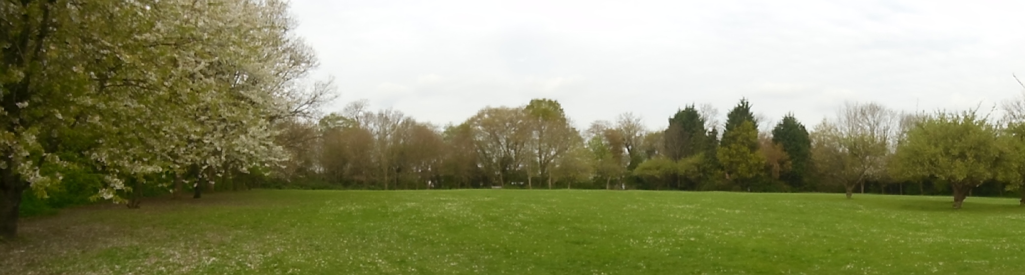
Billings Hill Shaw Recreation Ground which includes remnants of orchard