
Maps of Hartley
Go to History Homepage
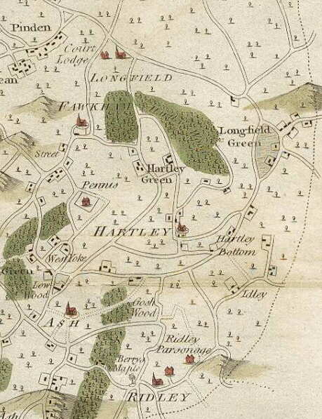 |
This is the first large scale map to show Hartley, which was included in Hasted's History of Kent in 1797. It was drawn by Andrews, Drury and Herbert in 1769 at a scale of 2 inches to the mile. They produced maps for each hundred (administrative unit). The picture on the left is an extract of their map for Axstane Hundred - roughly equivalent to the later Dartford Rural District Council.
The detail is astounding, but they did miss a few houses (eg. Brickend, Woodins, New House Farm and the Black Lion) and Hartley Wood is probably larger than it should be, but this in no way should detract from the mapmakers' great achievement.
The picture we get is one that is that that had existed from the 1600s. The only roads were Ash Road, Church Road, Castle Hill, St Johns Lane, Manor Lane, Grange Lane, Hartley Hill and Hartley Bottom Road. Most of the houses are faithfully reproduced, for example in Manor Lane leading from Stocks Farm you can see the
The scan of this map has been kindly supplied by The Old Map Shop, whose list of maps and prints for sale can be viewed at www.theoldmapshop.com/FrontPage.htm |
Links
1769
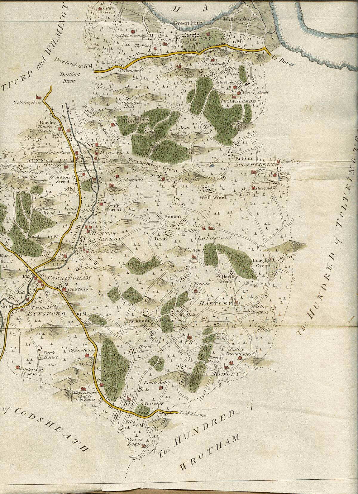
Andrews, Drury and Herbert map of Axstane Hundred (400kb jpeg file). Includes Greenhithe, Swanscombe, Southfleet, Longfield, Ash, Ridley, Fawkham, Sutton at Hone, Horton Kirby, Darenth, Farningham, Eynsford, West Kingsdown - as well as Hartley!
1787
Carey map of Kent (external link)
1831
Lewis map of Kent (external link)
1833
Map of Kent by G Virtue, 26 Ivy Lane, London - this extract shows the Dartford and Gravesend area.
1844
Tithe Map (including one with modern roads superimposed on top (Kent Archaeology Website)
1868
Map of West Kent for Parliamentary Boundary review (PDF file)
1893
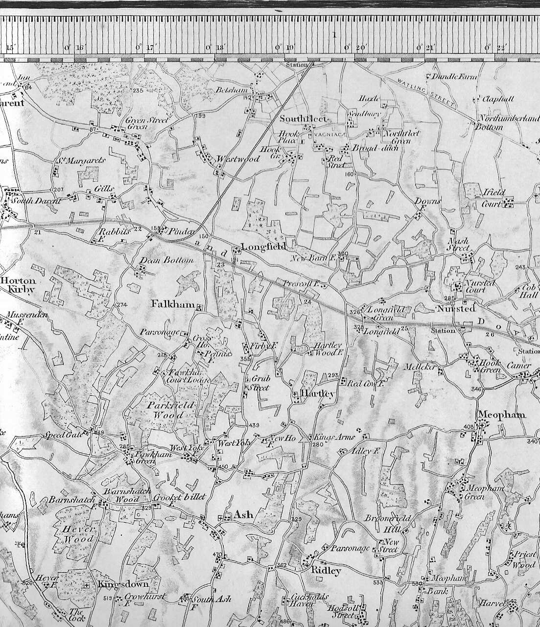
Ordnance Survey 1 inch map of Hartley area, including Horton Kirby to Harvel and Southfleet to West Kingsdown (seal at top of map is dated March 1893). Although dated 1893 it is actually based on the 1819 survey of Kent by Colonel Mudge, with an update for the railways in 1887. This means that some information is out of date eg. Hartley Bottom Farm is shown as the King's Arms which ceased to be a pub in 1872, and Old Downs and its outbuildings (built 1879-87) are not to be found.
1913
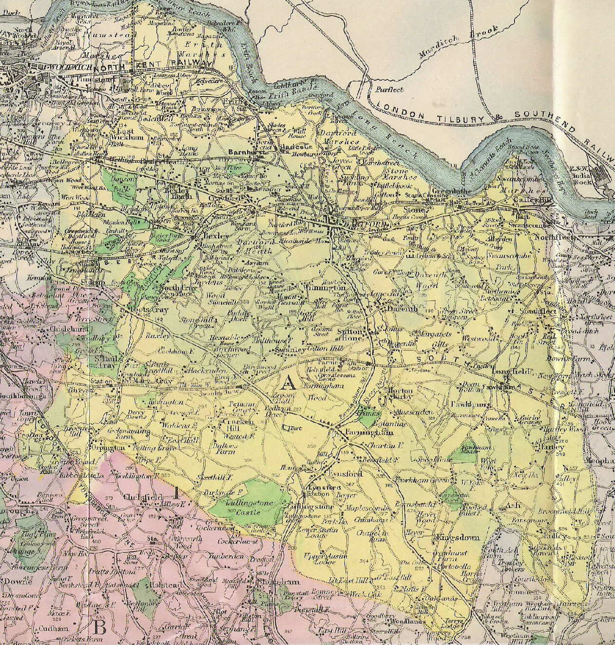
About 1¾ miles to the inch map from 1913 Kelly's Directory, apparently based on Ordnance Survey. The yellow colouring shows the extent of the Dartford parliamentary constituency, the pink to the south and west of Woodlands in West Kingsdown is Sevenoaks constituency, while the purple is Medway. Note the "West" had not yet been added to Kingsdown to differentiate it from its East Kent counterpart.
1914
Ordnance Survey 1 inch map of Hartley area (surveyed 1913/4, roads updated to 1931 with minor revisions to 1933). In it we see the beginnings of development, as the outlines of Wellfield, Larksfield. Woodland Avenue, Gresham Avenue and Merton Avenue can be seen, together with some of the houses built at the beginning of the 20th century.
1930
National Landuse Survey superimposed on Ordnance Survey 1 inch map of Hartley area (external link which cannot be centred on Hartley - it opens as a map of the UK and you will need to centre on Hartley)
1946
Ordnance Survey 1 inch map of Hartley area (PDF file, requires Acrobat reader)
2003
Our very own scale map of Hartley, drawn at a scale of approximately 6 inches to the mile. It includes land use and a gazetteer of roads.