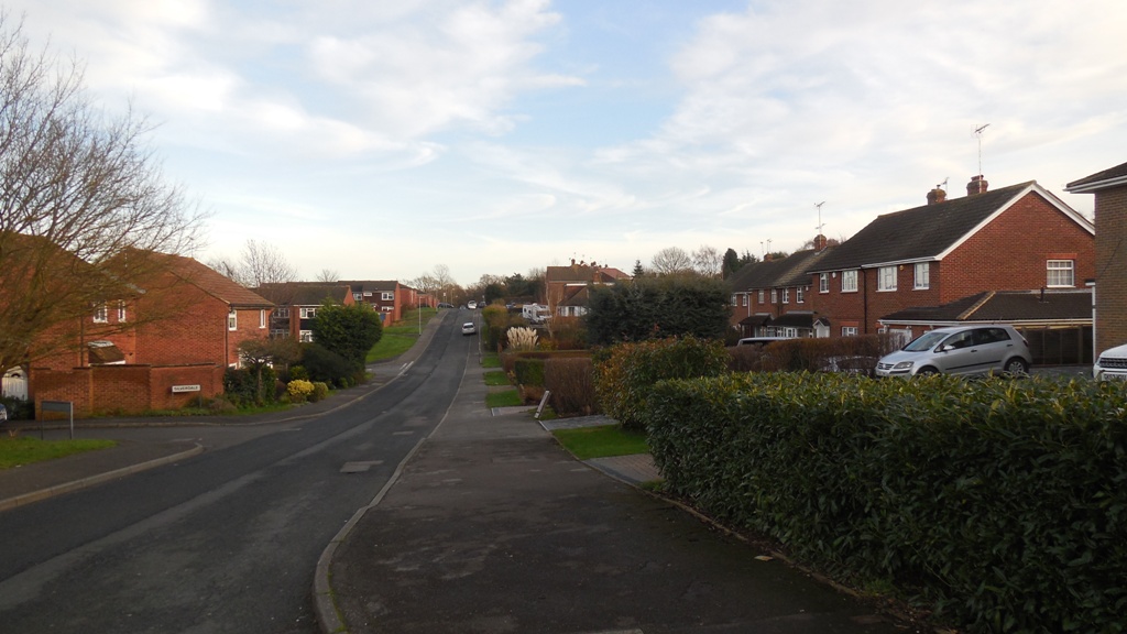
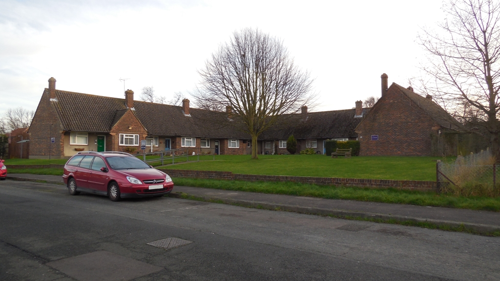
2 Wellfield DA3 7EQ
1949 Planning Application: (GRANTED) 1949/28 Erect dwellings (2-12 Wellfield)
1949 Planning Application: (GRANTED) 1949/28.1 Erect 22 houses, 4 bungalows (incl 2-12 Wellfield)
1956 Gross Rateable Value: £36
1963 Gross Rateable Value: £96
1972 Gross Rateable Value: £217
1993 Council Tax: C (£52-68K)
2000 Sale Price: £92995 (22 Sep 2000)
1844 Blue House Farm - Yew Tree Field
1905 Plot 28-29 Fawkham Park Estate
4 Wellfield DA3 7EQ
1949 Planning Application: (GRANTED) 1949/28 Erect dwellings (2-12 Wellfield)
1949 Planning Application: (GRANTED) 1949/28.1 Erect 22 houses, 4 bungalows (incl 2-12 Wellfield)
1956 Gross Rateable Value: £36
1963 Gross Rateable Value: £96
1972 Gross Rateable Value: £217
1993 Council Tax: C (£52-68K)
1844 Blue House Farm - Yew Tree Field
1905 Plot 28-29 Fawkham Park Estate
6 Wellfield DA3 7EQ
Semi-detached house (2 bedroom)
1949 Planning Application: (GRANTED) 1949/28 Erect dwellings (2-12 Wellfield)
1949 Planning Application: (GRANTED) 1949/28.1 Erect 22 houses, 4 bungalows (incl 2-12 Wellfield)
2021 Planning Application: (REFUSED) 2021/119 Demolition of rear conservatory and storage space. Erection of a side extensions and alterations to rear extension and storage space.
2021 Planning Application: (GRANTED) 2021/998 Demolishing existing conservatory space and re-designing, ground floor rear extension with additional space.
1956 Gross Rateable Value: £36
1963 Gross Rateable Value: £96
1972 Gross Rateable Value: £217
1993 Council Tax: C (£52-68K)
2002 Sale Price: £120000 (15 Feb 2002)
2006 Sale Price: £218995 (15 Dec 2006) Annual percentage change since 2002: +13%
2014 Sale Price: £260500 (26 Sep 2014) Annual percentage change since 2006: +2%
2016 Sale Price: £325000 (14 Jul 2016) Annual percentage change since 2014: +13%
1844 Blue House Farm - Yew Tree Field
1905 Plot 36 Fawkham Park Estate
8 Wellfield DA3 7EQ
1949 Planning Application: (GRANTED) 1949/28 Erect dwellings (2-12 Wellfield)
1949 Planning Application: (GRANTED) 1949/28.1 Erect 22 houses, 4 bungalows (incl 2-12 Wellfield)
2022 Planning Application: (GRANTED) 2022/2099 Proposed rear dormer loft conversion with installation of a new window
1956 Gross Rateable Value: £36
1963 Gross Rateable Value: £96
1972 Gross Rateable Value: £237
1993 Council Tax: C (£52-68K)
1954 Sale Price: £1500 (6 Apr 1954) Surveyor's valuation for enquiry about buying council house
1978 Sale Price: £11515 (25 Sep 1978) Under Housing Act 1957 Annual percentage change since 1954: +9%
2022 Sale Price: £383000 (22 Apr 2022) Annual percentage change since 1978: +8%
1844 Blue House Farm - Yew Tree Field
1905 Plot 37 Fawkham Park Estate
10 Wellfield DA3 7EQ
1949 Planning Application: (GRANTED) 1949/28 Erect dwellings (2-12 Wellfield)
1949 Planning Application: (GRANTED) 1949/28.1 Erect 22 houses, 4 bungalows (incl 2-12 Wellfield)
1956 Gross Rateable Value: £36
1963 Gross Rateable Value: £96
1972 Gross Rateable Value: £217
1993 Council Tax: C (£52-68K)
1844 Blue House Farm - Yew Tree Field
1905 Plot 38 Fawkham Park Estate
12 Wellfield DA3 7EQ
Semi-detached house (3 bedroom)
1949 Planning Application: (GRANTED) 1949/28 Erect dwellings (2-12 Wellfield)
1949 Planning Application: (GRANTED) 1949/28.1 Erect 22 houses, 4 bungalows (incl 2-12 Wellfield)
2002 Planning Application: (GRANTED) 2002/818 2 storey rear extension
1956 Gross Rateable Value: £36
1963 Gross Rateable Value: £96
1972 Gross Rateable Value: £237
1993 Council Tax: D (£68-88K)
1995 Sale Price: £74000 (15 Dec 1995)
1998 Sale Price: £80000 (27 Feb 1998) Annual percentage change since 1995: +4%
2001 Sale Price: £132000 (26 Oct 2001) Annual percentage change since 1998: +15%
2006 Sale Price: £265000 (28 Nov 2006) Annual percentage change since 2001: +15%
2011 Sale Price: £262500 (23 Jun 2011) Annual percentage change since 2006: -%
2013 Sale Price: £275000 (17 Dec 2013) Annual percentage change since 2011: +2%
1844 Blue House Farm - Yew Tree Field
1844 Blue House Farm - Yew Tree Field
1844 Blue House Farm - Yew Tree Field
1844 Blue House Farm - Yew Tree Field
1905 Plot 39 Fawkham Park Estate
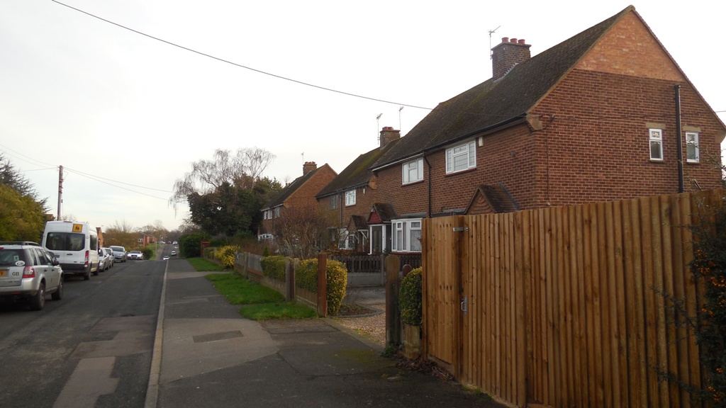
14 (Colyton) Wellfield DA3 7EQ
Detached house (3 bedroom)
1941 Planning Application: (GRANTED) 1941/3236 Garage
1974 Planning Application: (GRANTED) 1974/14 DEMOLITION OF EXISTING BUNGALOW (Perran) AND CONSTRUCTION OF 8 NEW DWELLINGS
1995 Planning Application: (GRANTED) 1995/424 House on land adjoining
1956 Gross Rateable Value: £50
1963 Gross Rateable Value: £145
1972 Gross Rateable Value: £
1993 Council Tax: G (£160-320K)
1907 Sale Price: £501 (1 Sep 1907)
1913 Sale Price: £550 (26 Jul 1913) Advertised price Annual percentage change since 1907: +2%
1844 Blue House Farm - Care Hill
1905 Plot 40-42 Fawkham Park Estate
16 (The Laurels) Wellfield DA3 7EQ
1993 Council Tax: G (£160-320K)
2002 Sale Price: £292000 (31 Jul 2002)
2016 Sale Price: £577500 (4 Mar 2016) Annual percentage change since 2002: +5%
1844 Blue House Farm - Care Hill
1905 Plot 43-44 Fawkham Park Estate
18 Wellfield DA3 7EQ
Detached house (4 bedroom, 115 sq m including garage)
1974 Planning Application: (GRANTED) 1974/14 DEMOLITION OF EXISTING BUNGALOW (Perran) AND CONSTRUCTION OF 8 NEW DWELLINGS
2021 Planning Application: (GRANTED) 2021/174 Demolition of single storey rear conservatory and erection of single storey hipped roofed extension.
1993 Council Tax: E (£88-120K)
1996 Sale Price: £103000 (25 Sep 1996)
2003 Sale Price: £268000 (29 Apr 2003) Annual percentage change since 1996: +16%
2014 Sale Price: £450000 (23 Sep 2014) Annual percentage change since 2003: +5%
2014 Sale Price: £445000 (13 Oct 2014) Annual percentage change since 2014: -18%
2015 Sale Price: £420000 (12 Jun 2015) Annual percentage change since 2014: -8%
1844 Blue House Farm - Care Hill
1905 Plot 46-47 Fawkham Park Estate
20 Wellfield DA3 7EQ
Detached House (3 bedrooms)
1953 Planning Application: (GRANTED) 1953/7149 Poultry House
1974 Planning Application: (GRANTED) 1974/14 DEMOLITION OF EXISTING BUNGALOW (Perran) AND CONSTRUCTION OF 8 NEW DWELLINGS
1956 Gross Rateable Value: £44
1963 Gross Rateable Value: £125
1972 Gross Rateable Value: £319
1993 Council Tax: E (£88-120K)
2006 Sale Price: £295000 (3 Nov 2006)
1844 Blue House Farm - Care Hill
1905 Plot 48-49 Fawkham Park Estate
Perran Wellfield DA3 7EQ
Former Name(s): Lenore (1951-1952); Fallowfield (1952-1967)
1966 Planning Application: (GRANTED) 1966/130 Garage and glazed verandah
1974 Planning Application: (GRANTED) 1974/14 DEMOLITION OF EXISTING BUNGALOW (Perran) AND CONSTRUCTION OF 8 NEW DWELLINGS
22 Wellfield DA3 7EQ
1961 Planning Application: (GRANTED) 1961/479 9 aged persons bungalows, 2 x 2 bedroom dwellings, 12 x 3 bedroom dwellings (22-32 and 38-70 Wellfield)
1985 Planning Application: (GRANTED) 1985/475 Garage
1987 Planning Application: (REFUSED) 1987/311 Erect dwelling at rear
2003 Planning Application: (GRANTED) 2003/651 Single storey side, front and rear extension.
2018 Planning Application: (GRANTED) 2018/1128 Proposed extensions for the conversion of detached garage and creation of a new dwelling.
2018 Planning Application: (GRANTED) 2018/2577 Details pursuant to condition 3 (ecological enhancement) of 18/01128/FUL.
2018 Planning Application: (GRANTED) 2018/2624 Details pursuant to condition 4 (soft landscape) of 18/01128/FUL.
1972 Gross Rateable Value: £261
1993 Council Tax: C (£52-68K)
2018 Sale Price: £435000 (16 Feb 2018)
1844 Blue House Farm - Care Hill
1905 Plot 50-51 Fawkham Park Estate
24 Wellfield DA3 7EQ
Semi-detached house (4 bedroom, 122 sq m + garage 23 sq m)
1961 Planning Application: (GRANTED) 1961/479 9 aged persons bungalows, 2 x 2 bedroom dwellings, 12 x 3 bedroom dwellings (22-32 and 38-70 Wellfield)
1979 Planning Application: (GRANTED) 1979/1900 EXTENSION TO REAR AND SIDE OF DWELLING INCORPORATING A GARAGE
1972 Gross Rateable Value: £241
1993 Council Tax: D (£68-88K)
1995 Sale Price: £102500 (25 Aug 1995)
2014 Sale Price: £335000 (21 Jul 2014) Annual percentage change since 1995: +6%
1844 Blue House Farm - Care Hill
1905 Plot 51-52 Fawkham Park Estate
26 (Hambourn) Wellfield DA3 7EQ
1961 Planning Application: (GRANTED) 1961/479 9 aged persons bungalows, 2 x 2 bedroom dwellings, 12 x 3 bedroom dwellings (22-32 and 38-70 Wellfield)
1989 Planning Application: (REFUSED) 1989/1045 2 storey side extension
2002 Planning Application: (WITHDRAWN) 2002/1343 Walk through conservatory
2002 Planning Application: (GRANTED) 2002/1776 Conservatory
1972 Gross Rateable Value: £210
1993 Council Tax: C (£52-68K)
2001 Sale Price: £212000 (7 Dec 2001)
2004 Sale Price: £280000 (18 Jun 2004) Annual percentage change since 2001: +12%
1844 Blue House Farm - Care Hill
1905 Plot 53 Fawkham Park Estate
28 Wellfield DA3 7EQ
1961 Planning Application: (GRANTED) 1961/479 9 aged persons bungalows, 2 x 2 bedroom dwellings, 12 x 3 bedroom dwellings (22-32 and 38-70 Wellfield)
1972 Gross Rateable Value: £230
1993 Council Tax: C (£52-68K)
1844 Blue House Farm - Care Hill
1905 Plot 54 Fawkham Park Estate
30 Wellfield DA3 7EQ
Semi-detached house (4 bedroom)
1961 Planning Application: (GRANTED) 1961/479 9 aged persons bungalows, 2 x 2 bedroom dwellings, 12 x 3 bedroom dwellings (22-32 and 38-70 Wellfield)
2009 Planning Application: (GRANTED) 2009/2093 Two storey flank extension: rear Conservatory: Detached single storey Garage/Games room/workshop.
2012 Planning Application: (GRANTED) 2012/1496 Detached garage
1972 Gross Rateable Value: £241
1993 Council Tax: C (£52-68K)
2009 Sale Price: £226000 (19 Aug 2009)
2011 Sale Price: £330000 (4 Nov 2011) Annual percentage change since 2009: +19%
1844 Blue House Farm - Care Hill
1905 Plot 55 Fawkham Park Estate
32 Wellfield DA3 7EQ
Semi-detached house (3 bedroom, 100 sq m + self contained bungalow in garden 1 bedroom, 60 sq m)
1961 Planning Application: (GRANTED) 1961/479 9 aged persons bungalows, 2 x 2 bedroom dwellings, 12 x 3 bedroom dwellings (22-32 and 38-70 Wellfield)
2019 Planning Application: (GRANTED) 2019/3536 Prior notification of a single storey rear extension which extends 5m beyond the rear wall of the original dwelling house with a maximum height of 2.5m and eaves height of 2.5m.
1972 Gross Rateable Value: £271
1993 Council Tax: C (£52-68K)
2007 Sale Price: £300000 (5 Apr 2007)
2017 Sale Price: £480000 (10 Feb 2017) Annual percentage change since 2007: +5%
1844 Blue House Farm - Care Hill
1905 Plot 56-57 Fawkham Park Estate
34 Wellfield DA3 7EQ
Detached house (3 bedroom)
1974 Planning Application: (GRANTED) 1974/377 THE ERECTION OF A DETACHED HOUSE WITH GARAGE (adjoining 34 Wellfield)
1976 Planning Application: (GRANTED) 1976/927 Rear Extension To Dwelling
2003 Planning Application: (GRANTED) 2003/2499 2 storey side extension
2004 Planning Application: (GRANTED) 2004/467 Details (materials) v 03/2499
2004 Planning Application: (GRANTED) 2004/832 Details (facing materials) v 03/2499
2012 Planning Application: (GRANTED) 2012/1508 Install 8 solar panels on roof
2012 Planning Application: (REFUSED) 2012/2456 Amend 12/1508 to allow 14 solar panels
2012 Planning Application: (INVALIDATED) 2012/2964 Amend 12/1508 to allow 14 solar panels
1963 Gross Rateable Value: £120
1972 Gross Rateable Value: £349
1993 Council Tax: F (£120-160K)
2008 Sale Price: £390000 (19 Dec 2008)
2023 Sale Price: £650000 (29 Mar 2023) Advertised price. Annual percentage change since 2008: +4%
1844 Blue House Farm - Care Hill
1905 Plot 58-59 Fawkham Park Estate
34.1 Wellfield DA3 7EQ
1974 Planning Application: (GRANTED) 1974/377 THE ERECTION OF A DETACHED HOUSE WITH GARAGE (adjoining 34 Wellfield)
1977 Planning Application: (REFUSED) 1977/308 Erection Of A Detached Double Garage At Front Of Dwelling
1993 Council Tax: F (£120-160K)
1844 Blue House Farm - Care Hill
1905 Plot 60 Fawkham Park Estate
36 Wellfield DA3 7EQ
Former Name(s): September (either this or 34)
1957 Planning Application: (GRANTED) 1957/226 Erect detached house
1958 Planning Application: (GRANTED) 1958/431 Temporary caravan on Plot 59
1979 Planning Application: (GRANTED) 1979/749 EXTENSIONS AND DORMER WINDOWS AT FRONT AND REAR OF DWELLING
1963 Gross Rateable Value: £143
1972 Gross Rateable Value: £362
1993 Council Tax: G (£160-320K)
1844 Blue House Farm - Care Hill
1905 Plot 61-62 Fawkham Park Estate
38 Wellfield DA3 7EQ
Semi-detached house (3 bedroom, 82.6 sq m + outhouse 4.6 sq m + garage 11 sq m)
1961 Planning Application: (GRANTED) 1961/479 9 aged persons bungalows, 2 x 2 bedroom dwellings, 12 x 3 bedroom dwellings (22-32 and 38-70 Wellfield)
1972 Gross Rateable Value: £261
1993 Council Tax: C (£52-68K)
2023 Sale Price: £425000 (28 Apr 2023) Advertised price.
1844 Blue House Farm - Care Hill
1905 Plot 63-64 Fawkham Park Estate
40 Wellfield DA3 7EQ
Semi-detached house (5 bedroom since extension, 129.4 sq m)
1959 Planning Application: (REFUSED) 1959/330 detached bungalow on Plots 61-2 (site of 40, 42)
1961 Planning Application: (GRANTED) 1961/479 9 aged persons bungalows, 2 x 2 bedroom dwellings, 12 x 3 bedroom dwellings (22-32 and 38-70 Wellfield)
2006 Planning Application: (WITHDRAWN) 2006/1975 2 storey side and rear extension
2007 Planning Application: (GRANTED) 2007/79 2 storey side and rear extension
1972 Gross Rateable Value: £241
1993 Council Tax: C (£52-68K)
2006 Sale Price: £250000 (19 Jul 2006)
2022 Sale Price: £590000 (18 Nov 2022) Advertised price. Planning permissions since previous sale Annual percentage change since 2006: +5%
1844 Blue House Farm - Care Hill
1905 Plot 64-65 Fawkham Park Estate
42 Wellfield DA3 7EQ
Semi-detached house (3 bedroom)
1959 Planning Application: (REFUSED) 1959/330 detached bungalow on Plots 61-2 (site of 40, 42)
1961 Planning Application: (GRANTED) 1961/479 9 aged persons bungalows, 2 x 2 bedroom dwellings, 12 x 3 bedroom dwellings (22-32 and 38-70 Wellfield)
2015 Planning Application: (GRANTED) 2015/1524 The erection of a 2 storey side and rear extension with a part single storey side and rear extension.
2015 Planning Application: (GRANTED) 2015/1709 Construction of a dropped kerb.
2022 Planning Application: (GRANTED) 2022/1795 Loft conversion with 2 x velux windows.
1972 Gross Rateable Value: £261
1993 Council Tax: C (£52-68K)
1977 Sale Price: £9400 (18 Jul 1977)
2013 Sale Price: £220000 (18 Oct 2013) Annual percentage change since 1977: +9%
1844 Blue House Farm - Care Hill
1905 Plot 66 Fawkham Park Estate
44 Wellfield DA3 7EQ
Semi-detached house (3 bedroom)
1961 Planning Application: (GRANTED) 1961/479 9 aged persons bungalows, 2 x 2 bedroom dwellings, 12 x 3 bedroom dwellings (22-32 and 38-70 Wellfield)
2021 Planning Application: (REFUSED) 2021/344 Part Single, Part Two Storey, Rear and Side Extensions
2022 Planning Application: (REFUSED) 2022/793 Part single, part two storey rear and side extension.
1972 Gross Rateable Value: £261
1993 Council Tax: C (£52-68K)
2018 Sale Price: £395000 (2 Nov 2018)
1844 Blue House Farm - Care Hill
1905 Plot 67 Fawkham Park Estate
46 Wellfield DA3 7EQ
1961 Planning Application: (GRANTED) 1961/479 9 aged persons bungalows, 2 x 2 bedroom dwellings, 12 x 3 bedroom dwellings (22-32 and 38-70 Wellfield)
1979 Planning Application: (GRANTED) 1979/785 DETACHED DOUBLE GARAGE AT REAR OF DWELLING TO REPLACE EXISTING SINGLE GARAGE
2014 Planning Application: (GRANTED) 2014/1662 Dropped kerb and creation of parking area.
1972 Gross Rateable Value: £261
1993 Council Tax: C (£52-68K)
2002 Sale Price: £179995 (8 Nov 2002)
2014 Sale Price: £300000 (21 Mar 2014) Annual percentage change since 2002: +5%
1844 Blue House Farm - Care Hill
1905 Plot 68 Fawkham Park Estate
48 Wellfield DA3 7EQ
Semi-detached house (3 bedroom)
1957 Planning Application: (GRANTED) 1957/143 Erect buildings (not built as a result of this PP)
1961 Planning Application: (GRANTED) 1961/479 9 aged persons bungalows, 2 x 2 bedroom dwellings, 12 x 3 bedroom dwellings (22-32 and 38-70 Wellfield)
1972 Gross Rateable Value: £241
1993 Council Tax: C (£52-68K)
2005 Sale Price: £245000 (9 Dec 2005)
1844 Blue House Farm - Care Hill
1905 Plot 69-70 Fawkham Park Estate
50 Wellfield DA3 7EQ
Semi-detached house (3 bedroom)
1957 Planning Application: (GRANTED) 1957/143 Erect buildings (not built as a result of this PP)
1961 Planning Application: (GRANTED) 1961/479 9 aged persons bungalows, 2 x 2 bedroom dwellings, 12 x 3 bedroom dwellings (22-32 and 38-70 Wellfield)
1972 Gross Rateable Value: £241
1993 Council Tax: D (£68-88K)
1995 Sale Price: £87000 (28 Sep 1995)
1844 Blue House Farm - Care Hill
1905 Plot 70-71 Fawkham Park Estate
52 Wellfield DA3 7EQ
Semi-detached house (4 bedroom)
1957 Planning Application: (GRANTED) 1957/143 Erect buildings (not built as a result of this PP)
1961 Planning Application: (GRANTED) 1961/479 9 aged persons bungalows, 2 x 2 bedroom dwellings, 12 x 3 bedroom dwellings (22-32 and 38-70 Wellfield)
1972 Gross Rateable Value: £241
1993 Council Tax: C (£52-68K)
1995 Sale Price: £85000 (22 Aug 1995)
1998 Sale Price: £122500 (18 Sep 1998) Annual percentage change since 1995: +13%
1999 Sale Price: £127000 (11 Jun 1999) Annual percentage change since 1998: +5%
2007 Sale Price: £317000 (30 Nov 2007) Annual percentage change since 1999: +11%
2014 Sale Price: £330000 (31 Jan 2014) Annual percentage change since 2007: +1%
2015 Rental (per month): £1350.
1844 Blue House Farm - Care Hill
1905 Plot 72 Fawkham Park Estate
54 Wellfield DA3 7EQ
1957 Planning Application: (GRANTED) 1957/143 Erect buildings (not built as a result of this PP)
1961 Planning Application: (GRANTED) 1961/479 9 aged persons bungalows, 2 x 2 bedroom dwellings, 12 x 3 bedroom dwellings (22-32 and 38-70 Wellfield)
1972 Gross Rateable Value: £166
1993 Council Tax: C (£52-68K)
1844 Middle Farm - Panefield
1905 Plot 73 Fawkham Park Estate
56 Wellfield DA3 7EQ
1957 Planning Application: (GRANTED) 1957/143 Erect buildings (not built as a result of this PP)
1961 Planning Application: (GRANTED) 1961/479 9 aged persons bungalows, 2 x 2 bedroom dwellings, 12 x 3 bedroom dwellings (22-32 and 38-70 Wellfield)
1972 Gross Rateable Value: £166
1993 Council Tax: C (£52-68K)
1844 Middle Farm - Panefield
1905 Plot 73 Fawkham Park Estate
58 Wellfield DA3 7EQ
1957 Planning Application: (GRANTED) 1957/143 Erect buildings (not built as a result of this PP)
1961 Planning Application: (GRANTED) 1961/479 9 aged persons bungalows, 2 x 2 bedroom dwellings, 12 x 3 bedroom dwellings (22-32 and 38-70 Wellfield)
1972 Gross Rateable Value: £166
1993 Council Tax: C (£52-68K)
1844 Middle Farm - Panefield
1905 Plot 74 Fawkham Park Estate
60 Wellfield DA3 7EQ
1957 Planning Application: (GRANTED) 1957/143 Erect buildings (not built as a result of this PP)
1961 Planning Application: (GRANTED) 1961/479 9 aged persons bungalows, 2 x 2 bedroom dwellings, 12 x 3 bedroom dwellings (22-32 and 38-70 Wellfield)
1972 Gross Rateable Value: £166
1993 Council Tax: C (£52-68K)
1844 Middle Farm - Panefield
1905 Plot 75 Fawkham Park Estate
62 Wellfield DA3 7EQ
1957 Planning Application: (GRANTED) 1957/143 Erect buildings (not built as a result of this PP)
1961 Planning Application: (GRANTED) 1961/479 9 aged persons bungalows, 2 x 2 bedroom dwellings, 12 x 3 bedroom dwellings (22-32 and 38-70 Wellfield)
1972 Gross Rateable Value: £166
1993 Council Tax: C (£52-68K)
1844 Middle Farm - Panefield
1905 Plot 76 Fawkham Park Estate
64 Wellfield DA3 7EQ
1957 Planning Application: (GRANTED) 1957/143 Erect buildings (not built as a result of this PP)
1961 Planning Application: (GRANTED) 1961/479 9 aged persons bungalows, 2 x 2 bedroom dwellings, 12 x 3 bedroom dwellings (22-32 and 38-70 Wellfield)
1972 Gross Rateable Value: £166
1993 Council Tax: C (£52-68K)
1844 Middle Farm - Panefield
1905 Plot 77 Fawkham Park Estate
66 Wellfield DA3 7EQ
1957 Planning Application: (GRANTED) 1957/143 Erect buildings (not built as a result of this PP)
1961 Planning Application: (GRANTED) 1961/479 9 aged persons bungalows, 2 x 2 bedroom dwellings, 12 x 3 bedroom dwellings (22-32 and 38-70 Wellfield)
1972 Gross Rateable Value: £166
1993 Council Tax: C (£52-68K)
1844 Middle Farm - Panefield
1905 Plot 77 Fawkham Park Estate
68 Wellfield DA3 7EQ
1957 Planning Application: (GRANTED) 1957/143 Erect buildings (not built as a result of this PP)
1961 Planning Application: (GRANTED) 1961/479 9 aged persons bungalows, 2 x 2 bedroom dwellings, 12 x 3 bedroom dwellings (22-32 and 38-70 Wellfield)
1972 Gross Rateable Value: £166
1993 Council Tax: C (£52-68K)
1844 Middle Farm - Panefield
1905 Plot 77 Fawkham Park Estate
70 Wellfield DA3 7EQ
1957 Planning Application: (GRANTED) 1957/143 Erect buildings (not built as a result of this PP)
1961 Planning Application: (GRANTED) 1961/479 9 aged persons bungalows, 2 x 2 bedroom dwellings, 12 x 3 bedroom dwellings (22-32 and 38-70 Wellfield)
1972 Gross Rateable Value: £166
1993 Council Tax: C (£52-68K)
1844 Middle Farm - Panefield
1905 Plot 77 Fawkham Park Estate