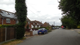
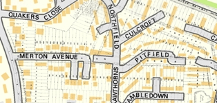
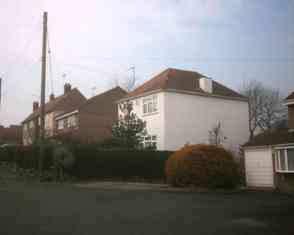
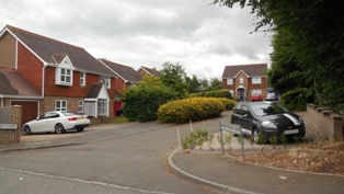
Merryfields Close (Merton Avenue)
| Item | Details |
| KCC Ref Length of Road | Merton Avenue P6198 (Private Street - Ash Road to bund) - 0.11 miles / 175m U23366 (Bund to Northfield) - 0.01 miles / 24m Fortuna Close P14139 (Private Street - 0.03 miles / 47m) Merryfields Close P14216 (Private Street - 0.03 miles / 47m) |
| Area (measured using MagicMap) | Merton Avenue - 3.9 acres / 1.6 hectares Fortuna Close - 0.7 acres / 0.3 hectares Merryfields Close - 0.8 acres / 0.3 hectares |
| Houses | Merton Avenue - 31 (7 detached houses, 1 detached chalet bungalow, 1 detached bungalow, 8 semi-detached houses, 2 semi-detached chalet bungalows, 2 semi-detached bungalows, 6 terraced houses, 4 flats) Fortuna Close - 5 (all detached houses) Merryfields Close - 5 (all detached houses) |
| Housing Density | Merton Avenue - 7.9 units per acre / 19.4 units per hectare Fortuna Close - 7.1 units per acre / 16.7 units per hectare Merryfields Close - 6.3 units per acre / 16.7 units per hectare |
| Population (2021) | Merton Avenue - 59 (2011 - 61) Fortuna Close - 11 (2011 - 17) Merryfields Close - 18 (2011 - 14) |
| Average Energy Consumption 2023 | Merton Avenue Electricity 3,410 KWh (55th out of 99 Hartley postcodes) Gas 14,173 KWh (57th out of 81 Hartley postcodes) Fortuna Close Electricity 3,986 KWh (37th out of 99 Hartley postcodes) Gas 14,756 KWh (62nd out of 81 Hartley postcodes) Merryfields Close Electricity 4,263 KWh (30th out of 99 Hartley postcodes) Gas 19,247 KWh (30th out of 81 Hartley postcodes) Figures are median KWh per household per annum |
1 Merryfields Close DA3 7HW
Detached House
Building History
1995 First Built
1972 Planning Application: (REFUSED) 1972/414 Demolish Wild Barfield, build 8 houses
1984 Planning Application: (GRANTED) 1984/1054 Erect 8 houses and garages
1988 Planning Application: (GRANTED) 1988/1180 Laying of foul drain across site
1991 Planning Application: (REFUSED) 1991/291 Erection of 12 no semi-detached dwellings with garages andassociated works
1991 Planning Application: (GRANTED) 1991/1781 Demolish Wild Barfield, replace with 5 detached houses
1991 Planning Application: (GRANTED) 1991/1781 Erection of 5 no detached houses with garages and estate road,as amended by letters and revised drawings received13.1.92,29.1.92,27.2.92.
1994 Planning Application: (GRANTED) 1994/197 Change house types on plots 1-4
1994 Planning Application: (GRANTED) 1994/197 Change of house types on plots 1 to 5 relative to planningpermission SE/91/1781 as amended by drawings accompanyingletter received 10/3/94.E`
1994 Planning Application: (GRANTED) 1994/749 Details of external finishes, landscaping and road constructions pursuant to conditions 2,3,5 and 6 of planning permission SE/94/0197.
1995 Planning Application: (REFUSED) 1995/1883 Retention of fence.
1996 Planning Application: (GRANTED) 1996/572 Revised application for retention of fence.
Rates and Council Tax
1995 Council Tax: G (£160-320K)
Sales and Rents
Site History
1604 Blue House Farm - Care Hill
1908 Plots 152-155 Fawkham Park Estate
2 Merryfields Close DA3 7HW
2019 Detached House (4 bedrooms, 154 sq m including garage)
Building History
1995 First Built
1972 Planning Application: (REFUSED) 1972/414 Demolish Wild Barfield, build 8 houses
1984 Planning Application: (GRANTED) 1984/1054 Erect 8 houses and garages
1988 Planning Application: (GRANTED) 1988/1180 Laying of foul drain across site
1991 Planning Application: (REFUSED) 1991/291 Erection of 12 no semi-detached dwellings with garages andassociated works
1991 Planning Application: (GRANTED) 1991/1781 Demolish Wild Barfield, replace with 5 detached houses
1991 Planning Application: (GRANTED) 1991/1781 Erection of 5 no detached houses with garages and estate road,as amended by letters and revised drawings received13.1.92,29.1.92,27.2.92.
1994 Planning Application: (GRANTED) 1994/197 Change house types on plots 1-4
1994 Planning Application: (GRANTED) 1994/197 Change of house types on plots 1 to 5 relative to planningpermission SE/91/1781 as amended by drawings accompanyingletter received 10/3/94.E`
1994 Planning Application: (GRANTED) 1994/749 Details of external finishes, landscaping and road constructions pursuant to conditions 2,3,5 and 6 of planning permission SE/94/0197.
Rates and Council Tax
1995 Council Tax: G (£160-320K)
Sales and Rents
2001 Sale Price: £287000 (31 Jul 2001)
2004 Sale Price: £333500 (29 Jan 2004) Annual percentage change since 2001: +6%
2019 Sale Price: £550000 (30 Aug 2019) Annual percentage change since 2004: +3%
Site History
1604 Blue House Farm - Care Hill
1908 Plots 152-155 Fawkham Park Estate
3 Merryfields Close DA3 7HW
2020 Detached House (4 bedrooms, 131.5 sq m + garage 13.6 sq m)
Building History
1995 First Built
1972 Planning Application: (REFUSED) 1972/414 Demolish Wild Barfield, build 8 houses
1984 Planning Application: (GRANTED) 1984/1054 Erect 8 houses and garages
1988 Planning Application: (GRANTED) 1988/1180 Laying of foul drain across site
1991 Planning Application: (REFUSED) 1991/291 Erection of 12 no semi-detached dwellings with garages andassociated works
1991 Planning Application: (GRANTED) 1991/1781 Demolish Wild Barfield, replace with 5 detached houses
1991 Planning Application: (GRANTED) 1991/1781 Erection of 5 no detached houses with garages and estate road,as amended by letters and revised drawings received13.1.92,29.1.92,27.2.92.
1994 Planning Application: (GRANTED) 1994/197 Change house types on plots 1-4
1994 Planning Application: (GRANTED) 1994/197 Change of house types on plots 1 to 5 relative to planningpermission SE/91/1781 as amended by drawings accompanyingletter received 10/3/94.E`
1994 Planning Application: (GRANTED) 1994/749 Details of external finishes, landscaping and road constructions pursuant to conditions 2,3,5 and 6 of planning permission SE/94/0197.
Rates and Council Tax
1995 Council Tax: G (£160-320K)
Sales and Rents
1999 Sale Price: £187000 (3 Sep 1999)
2020 Sale Price: £540000 (19 Jun 2020) Marketed Feb 20 at £545,000 Annual percentage change since 1999: +5%
Site History
1604 Blue House Farm - Care Hill
1908 Plots 152-155 Fawkham Park Estate
4 Merryfields Close DA3 7HW
2021 Detached House (4 bedrooms, 136.8 sq m) based on plan submitted to Sevenoaks Council
Building History
1995 First Built
1972 Planning Application: (REFUSED) 1972/414 Demolish Wild Barfield, build 8 houses
1984 Planning Application: (GRANTED) 1984/1054 Erect 8 houses and garages
1988 Planning Application: (GRANTED) 1988/1180 Laying of foul drain across site
1991 Planning Application: (REFUSED) 1991/291 Erection of 12 no semi-detached dwellings with garages andassociated works
1991 Planning Application: (GRANTED) 1991/1781 Demolish Wild Barfield, replace with 5 detached houses
1991 Planning Application: (GRANTED) 1991/1781 Erection of 5 no detached houses with garages and estate road,as amended by letters and revised drawings received13.1.92,29.1.92,27.2.92.
1994 Planning Application: (GRANTED) 1994/197 Change house types on plots 1-4
1994 Planning Application: (GRANTED) 1994/197 Change of house types on plots 1 to 5 relative to planningpermission SE/91/1781 as amended by drawings accompanyingletter received 10/3/94.E`
1994 Planning Application: (GRANTED) 1994/749 Details of external finishes, landscaping and road constructions pursuant to conditions 2,3,5 and 6 of planning permission SE/94/0197.
2021 Planning Application: (GRANTED) 2021/3801 Demolition of a conservatory and construction of a single storey rear extension.
Rates and Council Tax
1995 Council Tax: G (£160-320K)
Sales and Rents
2018 Sale Price: £545000 (24 Aug 2018)
Site History
1604 Blue House Farm - Care Hill
1908 Plots 152-155 Fawkham Park Estate
5 Merryfields Close DA3 7HW
Detached House (4 bedrooms)
Building History
1995 First Built
1972 Planning Application: (REFUSED) 1972/414 Demolish Wild Barfield, build 8 houses
1984 Planning Application: (GRANTED) 1984/1054 Erect 8 houses and garages
1988 Planning Application: (GRANTED) 1988/1180 Laying of foul drain across site
1991 Planning Application: (REFUSED) 1991/291 Erection of 12 no semi-detached dwellings with garages andassociated works
1991 Planning Application: (GRANTED) 1991/1781 Demolish Wild Barfield, replace with 5 detached houses
1991 Planning Application: (GRANTED) 1991/1781 Erection of 5 no detached houses with garages and estate road,as amended by letters and revised drawings received13.1.92,29.1.92,27.2.92.
1994 Planning Application: (GRANTED) 1994/197 Change of house types on plots 1 to 5 relative to planningpermission SE/91/1781 as amended by drawings accompanyingletter received 10/3/94.E`
1994 Planning Application: (GRANTED) 1994/749 Details of external finishes, landscaping and road constructions pursuant to conditions 2,3,5 and 6 of planning permission SE/94/0197.
Rates and Council Tax
1995 Council Tax: G (£160-320K)
Sales and Rents
2001 Sale Price: £249995 (31 Jan 2001)
2007 Sale Price: £385000 (29 Jan 2007) Annual percentage change since 2001: +7%
2010 Sale Price: £372500 (26 May 2010) Annual percentage change since 2007: -1%
2017 Sale Price: £540000 (31 Jul 2017) Marketed in 2016 for £509,995 Annual percentage change since 2010: +5%
Site History
1604 Blue House Farm - Care Hill
1908 Plots 152-155 Fawkham Park Estate


