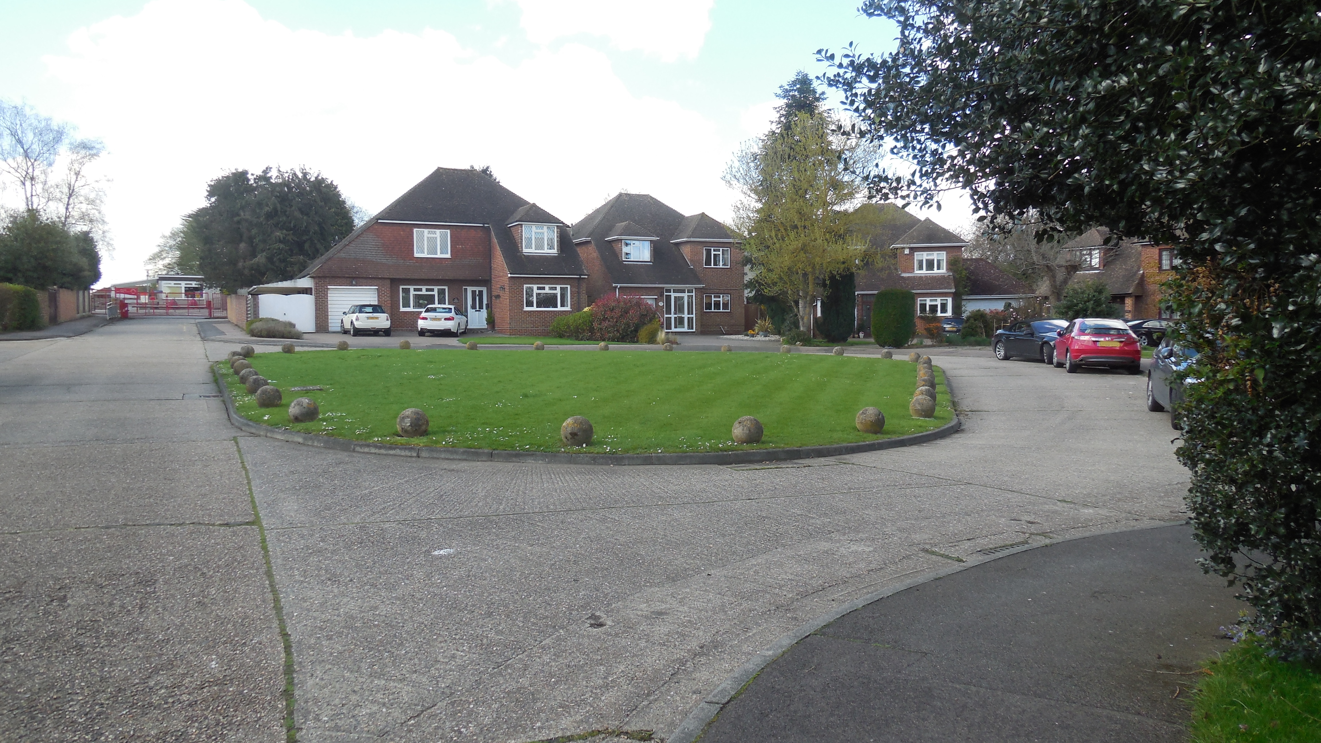
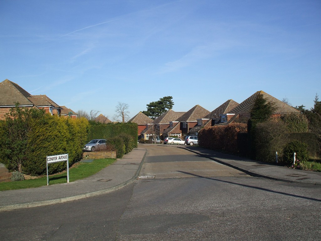
Oast Way (Round Ash Way) - Hartley-Kent: Covering Hartley, Longfield & District

Go to content

Oast Way (Round Ash Way)

Info > Places > M-P
About the roads
 
Round Ash Way: (1) The Green and 26-30; (2) From Ash Road entrance

Round Ash Way, Oast Way and Conifer Avenue were built in two phases on land that was formerly part of Fairby Grange. All the road names are fairly explanatory, although Round Ash Way has lost the Ash tree which once stood on the southern corner of the green that gives the road its name.  I believe the green is not a public land but privately owned by the surrounding houses, with a covenant to leave it open.

Originally the houses were named, but in 1973 the roads were numbered at the request of the residents to make it easier for public services.

Round Ash Way has 26 detached houses, leading to the Primary School, while another dozen detached houses make up Conifer Avenue. However Oast Way is a little different with 6 detached houses and 8 bungalows in pairs joined by their garages.

Round Ash Way: 1844 map (red lines and green numbers) and 1936 map (black and white) superimposed on modern map (colour).

Contains OS data (c) Crown Copyright 2016.  

Key to 1844 parcel numbers: 106 (Lower Meadow, formerly part of Plotfield), 107 (Upper Meadow, formerly part of Plotfield), 109 (Long Shaw), 110-111 (Three Acre Field, formerly Little Nutfield), 112 (Orchard, formerly part of Great Nutfield), 113 (Cherry Orchard, formerly part of Great Nutfield)
From the earliest the land that underlies Round Ash Way belonged to Fairby Farm, in the 19th century it was pasture land called Upper Meadow and Lower Meadow. When Alfred Salter bought Fairby and the remaining 13 acres of grounds in 1917, he turned the house into a nursing home for mothers and babies, while the grounds became a nursery too - of trees and flowers to beautify his borough of Bermondsey. According to Fenner Brockway ("The Bermondsey Story") "One of his first actions after Labour secured a majority in 1922 was to present it to the borough council for two purposes: the building and the gardens were to be used to rehabilitate the lives of mothers and children after childbirth or illness, the estate was to be used to grow trees and flowers for the beautification of Bermondsey. Mr W H Johns, the Borough Gardens Superintendent, soon got to work plaing striplings of elms, poplars, planes and acacias in long rows, and within a year they were being transplanted to the streets of Bermondsey". Local people in Bermondsey were also offered bulbs from Fairby to make their own window boxes.

During the last war the land that would become Round Ash Way was mainly growing vegetables, with 2 acres of grassland being ploughed up for the first time in 1941. The War Agricultual Executive was impressed with the management, giving a grade A status.

 
Conifer Avenue (1) From Round Ash Way (2) From Fairby Lane

When Fairby Grange was being sold by Bermondsey Council, a number of prospective purchasers applied for planning permission to see what the council's attidude would be (applications 54/339 and 55/80), as well as the eventual purchaser - Ron Billings. He applied in 1957 for what would become Round Ash Way, Conifer Avenue and Oast Way (application 57/258). It was a complicated application, with negotiations about mains drainage and the siting of the school to be settled before building could take place. The roads might have looked very different too - a 1961 draft shows 28 houses in Round Ash Way and no "round ash" at all; instead there would have been a grass verge in front of the even numbers. In addition Conifer Avenue would not have carried on to Fairby Lane. The conveyance of the school site for £38,000 (29 November 1963) shows a very different Oast Way, which would have joined Fairby Lane, instead of Conifer Avenue.

The road was built in two phases.  Round Ash Way was built 1963-1964, with Conifer Avenue and Oast Way following in phase 2 in 1968-1970.  The road surface is concrete slabs rather than tarmacadam.  It has proved to be a very durable surface.

 
Oast Way (1) From Conifer Avenue (2) From Round Ash Way

Statistics about the road
Subject
Details
Length of Roads
Conifer Avenue: 0.11 miles (173m)
Oast Way: 0.10 miles (163m)
Round Ash Way: 0.21 miles (334m)
KCC Reference:
Conifer Avenue:    U14682 (Adopted)
Oast Way:    U12895 (Adopted)
Round Ash Way:    U12434 (Adopted)
Acreage:
Gross density measured using Magic Map, roads and pavements included.
Conifer Avenue: 1.90 acres (0.77 ha)
Oast Way: 2.17 acres (0.88 ha)
Round Ash Way: 5.09 acres (2.06 ha)
Houses:
Conifer Avenue: 13
Oast Way: 14
Round Ash Way: 26
Density:
Conifer Avenue: 6.8 houses/acre (20.6 houses/ha)
Oast Way: 6.4 houses/acre (15.9 houses/ha)
Round Ash Way: 5.1 houses/acre (12.6 houses/ha)
(Hartley average 4.9 houses/acre)
Population (2021):
Conifer Avenue: 37 (2011 - 41)
Oast Way: 28 (2011 - 26)
Round Ash Way: 76 (2011 - 70)
Companies with registered address here (2025):
Conifer Avenue: 1
Oast Way: 0
Round Ash Way: 2
Same numbers in 2013
Information about the houses
Updated 19.6.2025

Explanation:

This is information collected from various sources about the houses, divided as follows:

(1) Description - this has mostly been drawn from sale adverts and observation from the road.  Names of properties are included if the road is not numbered or the name appears as well as the number in the offical Royal Mail address.  Changes of name and the date, where known, are also included here.  Area measurements can be done in a number of ways, so may get differing results.

(2) Building History - the date of construction is sometimes approximate as it is based on the property appearing in the electoral register or the subject of a planning permission etc.

(3) Rates and Council Tax - the rates registers for 1956, 1963 and 1972 are held by Sevenoaks Council.  I have included the gross rateable value, that is the amount it was thought the property could be rented out for.  For some reason the 1956 valuation is actually what the rental would have been in 1939.  The rateable value was then subject to certain statutory deductions and this figure is what people paid rates upon.  Council tax was introduced in 1993, the value was (and still is) what it was believed the property would have sold for on 1 April 1991.  However significant building works means it can be increased when the property is next sold and this is shown by "improvement indicator".

(4) Sales and Rents - mostly from property adverts and Land Registry records.  Of course those based on adverts may not be the price it actually sold for.  There are some cases of property valuations for mortgages from Dartford Rural District Council.  House price data 1995 to date produced by Land Registry © Crown copyright 2023. To report an error, go to <a href="https://help.landregistry.gov.uk/app/contactus_changesales">Change a sales record form</a>.

(5) Site history - this contains a selection of records which demonstrate which farm and field the property stands upon.

I have tried to make sure the information is accurate, but no responsibility can be taken for any errors. If you plan to rely on the information, you should check the source data to be sure. If you spot an error, please let me know via the <a href="http://www.hartley-kent.org.uk/feedback.htm">contact form</a>.


Oast Way (North Side)


1 Oast Way DA3 8BU

2024  Link Detached Bungalow (3 bedroom, 94.4 sq m + garage 18.3 sq m)

Former Name(s): Maltings (to 1970)

Building History

1969  First Built

Rates and Council Tax

1972  Gross Rateable Value: £408

1993  Council Tax: F (£120-160K)  Banding confirmed by Valuation Tribunal (1993)

Sales and Rents

2024  Sale Price: £450000 (31 May 2024)    

Site History

1604  Part of Fairby Farm - Great Nutfield

1844  Part of Fairby Farm - Orchard (1½ acres)


3 Oast Way DA3 8BU

2023  Link Detached Bungalow (3 bedroom, 94.4 sq m + garage 18.3 sq m)

Former Name(s): Rangimarie (to 1970)

Building History

1969  First Built

Rates and Council Tax

1972  Gross Rateable Value: £408

1993  Council Tax: F (£120-160K)  

Sales and Rents

2023  Sale Price: £430000 (15 Nov 2023)    

Site History

1604  Part of Fairby Farm - Great Nutfield

1844  Part of Fairby Farm - Orchard (1½ acres)


5 Oast Way DA3 8BU

Link Detached Bungalow

Former Name(s): Kimberley (to 1970)

Building History

1970  First Built

Rates and Council Tax

1972  Gross Rateable Value: £408

1993  Council Tax: F (£120-160K)  

Sales and Rents

1970  Sale Price: £7850 (24 Apr 1970)  Based on £78.50 stamp duty paid (1% on sales over £7,000)  

1996  Sale Price: £106000 (19 Aug 1996)    Annual percentage change since 1970: +10%

2001  Sale Price: £237000 (16 Nov 2001)    Annual percentage change since 1996: +17%

Site History

1604  Part of Fairby Farm - Great Nutfield

1844  Part of Fairby Farm - Orchard (1½ acres)


7 Oast Way DA3 8BU

2018  Link Detached Bungalow (3 bedroom, 91.6 sq m + garage 17.7 sq m + conservatory 10.8 sq m).  Based on internal wall measurements from plan submitted to Sevenoaks Council

2020  Link Detached Bungalow (3 bedroom, 105.1 sq m + garage 17.7 sq m).  Based on internal wall measurements from plan submitted to Sevenoaks Council

Former Name(s): Ideford and Wyndana (to 1970)

Building History

1970  First Built

2019  Planning Application: (GRANTED) 2019/2405 Demolition of rear conservatory and construction of single storey rear extension and associated internal alterations.

Rates and Council Tax

1972  Gross Rateable Value: £408

1993  Council Tax: F (£120-160K)  

Sales and Rents

2019  Sale Price: £445000 (25 Apr 2019)    

Site History

1604  Part of Fairby Farm - Little Nut Field (3¼ acres)


9 Oast Way DA3 8BU

Link Detached Bungalow

Former Name(s): Can Picafort (to 1970)

Building History

1970  First Built

Rates and Council Tax

1972  Gross Rateable Value: £408

1993  Council Tax: F (£120-160K)  

Sales and Rents

2005  Sale Price: £315000 (29 Apr 2005)    

Site History

1604  Part of Fairby Farm - Little Nut Field (3¼ acres)


11 Oast Way DA3 8BU

Link Detached Bungalow

Former Name(s): White Gables (to 1970)

Building History

1970  First Built

Rates and Council Tax

1972  Gross Rateable Value: £408

1993  Council Tax: F (£120-160K)  

Sales and Rents

Site History

1604  Part of Fairby Farm - Little Nut Field (3¼ acres)


13 Oast Way DA3 8BU

Link Detached Bungalow (3 bedroom)

Former Name(s): Warwick (to 1970)

Building History

1969  First Built

Rates and Council Tax

1972  Gross Rateable Value: £408

1993  Council Tax: F (£120-160K)  

Sales and Rents

2003  Sale Price: £284995 (6 Aug 2003)    

Site History

1604  Part of Fairby Farm - Little Nut Field (3¼ acres)


15 Oast Way DA3 8BU

2009  Link Detached Bungalow (3 bedroom)

Former Name(s): Roundel (to 1970)

Building History

1969  First Built

Rates and Council Tax

1972  Gross Rateable Value: £408

1993  Council Tax: F (£120-160K)  

Sales and Rents

2014  Sale Price: £394500 (21 Aug 2014)    

Site History

1604  Part of Fairby Farm - Little Nut Field (3¼ acres)


17 Oast Way DA3 8BU

Detached House

Former Name(s): Ventura (to 1970)

Building History

1968  First Built

Rates and Council Tax

1972  Gross Rateable Value: £499

1993  Council Tax: G (£160-320K)  

Sales and Rents

1974  Sale Price: £22950 (4 May 1974)  Advertised price (Sevenoaks Chron)  

Site History

1604  Part of Fairby Farm - Little Nut Field (3¼ acres)


19 Oast Way DA3 8BU

2025  Detached House (4 bedroom, 142.6 sq m + garage 15.2 sq m)

Former Name(s): Argil (to 1970)

Building History

1968  First Built

Rates and Council Tax

1972  Gross Rateable Value: £499

1993  Council Tax: G (£160-320K)  

Sales and Rents

2024  Sale Price: £660000 (6 Dec 2024)  Advertised at £685,000  

Site History

1604  Part of Fairby Farm - Little Nut Field (3¼ acres)


21 Oast Way DA3 8BU

2017  Detached House (4 bedroom 152.7 sq m+ garage 25.9 sq m + conservatory 8.4 sq m)

Former Name(s): Ashoka (to 1970)

Building History

1963  First Built

2018  Planning Application: (GRANTED) 2018/453  Demolition of existing garage. Erection of a 2 storey side extension, porch extension and alterations to fenestration.

Rates and Council Tax

1972  Gross Rateable Value: £570

1993  Council Tax: G (£160-320K)  With improvement indicator (2025)

Sales and Rents

1980  Sale Price: £61000 (6 Mar 1980)    

2017  Sale Price: £670000 (1 Dec 2017)  Marketed at £725,000 (Aug 2017)  Annual percentage change since 1980: +7%

Site History

1844  Part of Fairby Farm - Upper Meadow (4 acres)


Oast Way (South Side)


2 Oast Way DA3 8BU

Detached House (4 bedroom)

Former Name(s): Calella (to 1970)

Building History

1969  First Built

1998  Planning Application: (GRANTED) 1998/1127 Single storey rear extension

2007  Planning Application: (GRANTED) 2007/3089 2 storey rear extension

2019  Planning Application: (GRANTED) 2019/721 To heighten an existing boundary wall.

Rates and Council Tax

1972  Gross Rateable Value: £462

1993  Council Tax: F (£120-160K)  

Sales and Rents

1975  Sale Price: £26000 (25 Sep 1975)    

1998  Sale Price: £179000 (20 Feb 1998)    Annual percentage change since 1975: +9%

2002  Sale Price: £324000 (18 Dec 2002)    Annual percentage change since 1998: +13%

Site History

1604  Part of Fairby Farm - Little Nut Field (3¼ acres)


4 Oast Way DA3 8BU

Detached House (4 bedroom)

Former Name(s): Kirabalu (to 1970)

Building History

1968  First Built

1993  Planning Application: (GRANTED) 1993/228 Single Storey rear extension

1995  Planning Application: (GRANTED) 1995/59 Details of bricks pursuant to condition 2 of planningpermission SE/93/0228.

Rates and Council Tax

1972  Gross Rateable Value: £457

1993  Council Tax: F (£120-160K)  

Sales and Rents

2000  Sale Price: £266000 (11 Aug 2000)    

Site History

1604  Part of Fairby Farm - Little Nut Field (3¼ acres)


6 Oast Way DA3 8BU

2010  Detached House (4 bedroom)

Former Name(s): Tequendama (to 1970)

Building History

1969  First Built

1973  Planning Application: (GRANTED) 1973/Meeting Sep 73 (2) Dining room extension at rear

1975  Planning Application: (GRANTED) 1975/529 Detached garage at rear

Rates and Council Tax

1972  Gross Rateable Value: £457

1993  Council Tax: G (£160-320K)  

Sales and Rents

2010  Sale Price: £430000 (26 Nov 2010)    

Site History

1604  Part of Fairby Farm - Plotfield (7 acres)

1648  Part of Fairby Farm - Seven Acres (7 acres)

1844  Part of Fairby Farm - Lower Meadow (3¼ acres)


© Content P Mayer 2000-2025.  Created with WebSite X5
Some pages contain public  sector information licensed under the Open Government Licence v3.0.  
Some pages contain OS data © Crown copyright and  database right [2021]
Back to content