
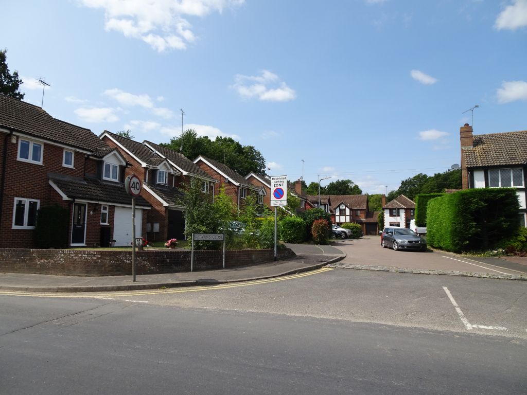
Rowans Close
Subject | Details |
| Length of Roads | 61m (0.2 miles) |
| KCC Reference: | U23392 (Unclassified Single Carriageway - adopted) |
| Acreage: | 1.1 acres (0.4 hectares) Source: Magic Map |
| Houses: | 12 (Detached 10, Link detached 2) |
| Density: | 11 houses/acre (27.9 / hectare) |
| Population (2021): | 39 (2011 - 36) |
| Companies with registered address here (2026): | 1 |
| Energy Consumption (annual average per household 2023) | Electricity 3,906 KWh (DA3 area average 4,213 KWh) Gas 16,487 KWh (DA3 area average 14,380 KWh) |
1 Rowans Close DA3 7QU
Detached house (90 sq m - EPC certificate)
Building History
1990 First built
1947 Planning Application:
(GRANTED) 1947/04074 Garage 'A' Garden Shed 'B'
1959 Planning Application:
(GRANTED) 1959/00382 Additional Details Of New Depot Building.
1984 Planning Application:
(GRANTED) 1984/01546 Light Industrial Development
1984 Planning Application:
(GRANTED) 1984/01547 Residential Development
1986 Planning Application:
(GRANTED) 1986/00954 Erctn Of 11 Detached Houses.
1988 Planning Application:
(GRANTED) 1988/01112 Erected Under This Number,P.D. Rights Affected Site History Se/84/1547 Se/86/954 DA/88/1112 Erctn Of 11 No Detached Houses With Associated Garages & New Access Road. Affects Whole Site But Only Plots 1-4 & 11 Completed
Rates and Council Tax
1993 Council Tax: E (£88-120K)
Sales and Rents
Plot History
1737 Part of 19¾ acre Mill Field (Map of Longfield Court, 1737)
1848 Still part of Longfield Court - Mill Field (Tithe Map)
1865 Land part of lot 6 in sale of Longfield Court Estate by Ecclesiatical Commissioners
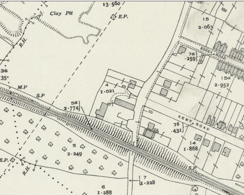
1918 Land on west side of Fawkham Road between Main Road and the Railway sold by Mabel Caroline Hohler to Dartford Rural District Council. Rowans Close was where they built a council road depot
2 Rowans Close DA3 7QU
Detached house (100 sq m - EPC certificate)
Building History
1990 First built
1947 Planning Application:
(GRANTED) 1947/04074 Garage 'A' Garden Shed 'B'
1959 Planning Application:
(GRANTED) 1959/00382 Additional Details Of New Depot Building.
1984 Planning Application:
(GRANTED) 1984/01546 Light Industrial Development
1984 Planning Application:
(GRANTED) 1984/01547 Residential Development
1986 Planning Application:
(GRANTED) 1986/00954 Erctn Of 11 Detached Houses.
1988 Planning Application:
(GRANTED) 1988/01112 Erected Under This Number,P.D. Rights Affected Site History Se/84/1547 Se/86/954 DA/88/1112 Erctn Of 11 No Detached Houses With Associated Garages & New Access Road. Affects Whole Site But Only Plots 1-4 & 11 Completed
Rates and Council Tax
1993 Council Tax: E (£88-120K)
Sales and Rents
2002 Sale Price: £189950 (27 Mar 2002)
Plot History
1737 Part of 19¾ acre Mill Field (Map of Longfield Court, 1737)
1848 Still part of Longfield Court - Mill Field (Tithe Map)
1865 Land part of lot 6 in sale of Longfield Court Estate by Ecclesiatical Commissioners
1918 Land on west side of Fawkham Road between Main Road and the Railway sold by Mabel Caroline Hohler to Dartford Rural District Council. Rowans Close was where they built a council road depot
3 Rowans Close DA3 7QU
Detached house
Building History
1990 First built
1947 Planning Application:
(GRANTED) 1947/04074 Garage 'A' Garden Shed 'B'
1959 Planning Application:
(GRANTED) 1959/00382 Additional Details Of New Depot Building.
1984 Planning Application:
(GRANTED) 1984/01546 Light Industrial Development
1984 Planning Application:
(GRANTED) 1984/01547 Residential Development
1986 Planning Application:
(GRANTED) 1986/00954 Erctn Of 11 Detached Houses.
1988 Planning Application:
(GRANTED) 1988/01112 Erected Under This Number,P.D. Rights Affected Site History Se/84/1547 Se/86/954 DA/88/1112 Erctn Of 11 No Detached Houses With Associated Garages & New Access Road. Affects Whole Site But Only Plots 1-4 & 11 Completed
Rates and Council Tax
1993 Council Tax: E (£88-120K)
Sales and Rents
Plot History
1737 Part of 19¾ acre Mill Field (Map of Longfield Court, 1737)
1848 Still part of Longfield Court - Mill Field (Tithe Map)
1865 Land part of lot 6 in sale of Longfield Court Estate by Ecclesiatical Commissioners
1918 Land on west side of Fawkham Road between Main Road and the Railway sold by Mabel Caroline Hohler to Dartford Rural District Council. Rowans Close was where they built a council road depot
4 Rowans Close DA3 7QU
Detached house (201 sq m - EPC certificate)
Building History
1990 First built
1947 Planning Application:
(GRANTED) 1947/04074 Garage 'A' Garden Shed 'B'
1959 Planning Application:
(GRANTED) 1959/00382 Additional Details Of New Depot Building.
1984 Planning Application:
(GRANTED) 1984/01546 Light Industrial Development
1984 Planning Application:
(GRANTED) 1984/01547 Residential Development
1986 Planning Application:
(GRANTED) 1986/00954 Erctn Of 11 Detached Houses.
1988 Planning Application:
(GRANTED) 1988/01112 Erected Under This Number,P.D. Rights Affected Site History Se/84/1547 Se/86/954 DA/88/1112 Erctn Of 11 No Detached Houses With Associated Garages & New Access Road. Affects Whole Site But Only Plots 1-4 & 11 Completed
Rates and Council Tax
1993 Council Tax: E (£88-120K)
Sales and Rents
Plot History
1737 Part of 19¾ acre Mill Field (Map of Longfield Court, 1737)
1848 Still part of Longfield Court - Mill Field (Tithe Map)
1865 Land part of lot 6 in sale of Longfield Court Estate by Ecclesiatical Commissioners
1918 Land on west side of Fawkham Road between Main Road and the Railway sold by Mabel Caroline Hohler to Dartford Rural District Council. Rowans Close was where they built a council road depot
5 Rowans Close DA3 7QU
Detached house
Building History
1992 First built
1947 Planning Application:
(GRANTED) 1947/04074 Garage 'A' Garden Shed 'B'
1959 Planning Application:
(GRANTED) 1959/00382 Additional Details Of New Depot Building.
1984 Planning Application:
(GRANTED) 1984/01546 Light Industrial Development
1984 Planning Application:
(GRANTED) 1984/01547 Residential Development
1986 Planning Application:
(GRANTED) 1986/00954 Erctn Of 11 Detached Houses.
1990 Planning Application:
(GRANTED) 1990/00415 Erected Under This Number, P.D. Rights Affected. Nhbc Complete 11.11.91 Site History Se/84/1547 86/954 DA/88/1112 Erctn Of 7 No 4 Bed Detached Dwelling Houses With Assoc Garaging Access Road, Landscaping & Fencing. (STC) To Become 5-9A & 10 Rowans Close. N.H.B.C.
Rates and Council Tax
1993 Council Tax: F (£120-160K)
Sales and Rents
Plot History
1737 Part of 19¾ acre Mill Field (Map of Longfield Court, 1737)
1848 Still part of Longfield Court - Mill Field (Tithe Map)
1865 Land part of lot 6 in sale of Longfield Court Estate by Ecclesiatical Commissioners
1918 Land on west side of Fawkham Road between Main Road and the Railway sold by Mabel Caroline Hohler to Dartford Rural District Council. Rowans Close was where they built a council road depot
6 Rowans Close DA3 7QU
Detached house (4 bedroom; 143 sq m - EPC certificate)
Building History
1992 First built
1947 Planning Application:
(GRANTED) 1947/04074 Garage 'A' Garden Shed 'B'
1959 Planning Application:
(GRANTED) 1959/00382 Additional Details Of New Depot Building.
1984 Planning Application:
(GRANTED) 1984/01546 Light Industrial Development
1984 Planning Application:
(GRANTED) 1984/01547 Residential Development
1986 Planning Application:
(GRANTED) 1986/00954 Erctn Of 11 Detached Houses.
1990 Planning Application:
(GRANTED) 1990/00415 Erected Under This Number, P.D. Rights Affected. Nhbc Complete 11.11.91 Site History Se/84/1547 86/954 DA/88/1112 Erctn Of 7 No 4 Bed Detached Dwelling Houses With Assoc Garaging Access Road, Landscaping & Fencing. (STC) To Become 5-9A & 10 Rowans Close. N.H.B.C.
2007 Planning Application:
(GRANTED) 2007/00174 Erection of a single storey side/rear extension to garage (to accommodate ice cream van)
2007 Planning Application:
(GRANTED) 2007/01182 Show more description
2008 Planning Application:
(GRANTED) 2008/01541 Erection of a first floor front extension
Rates and Council Tax
1993 Council Tax: F (£120-160K)
Sales and Rents
2001 Sale Price: £250000 (11 May 2001)
2011 Sale Price: £377500 (21 Jan 2011)
Annual percentage change since 2001: +4%
Plot History
1737 Part of 19¾ acre Mill Field (Map of Longfield Court, 1737)
1848 Still part of Longfield Court - Mill Field (Tithe Map)
1865 Land part of lot 6 in sale of Longfield Court Estate by Ecclesiatical Commissioners
1918 Land on west side of Fawkham Road between Main Road and the Railway sold by Mabel Caroline Hohler to Dartford Rural District Council. Rowans Close was where they built a council road depot
7 Rowans Close DA3 7QU
Detached house
Building History
1992 First built
1947 Planning Application:
(GRANTED) 1947/04074 Garage 'A' Garden Shed 'B'
1959 Planning Application:
(GRANTED) 1959/00382 Additional Details Of New Depot Building.
1984 Planning Application:
(GRANTED) 1984/01546 Light Industrial Development
1984 Planning Application:
(GRANTED) 1984/01547 Residential Development
1986 Planning Application:
(GRANTED) 1986/00954 Erctn Of 11 Detached Houses.
1990 Planning Application:
(GRANTED) 1990/00415 Erected Under This Number, P.D. Rights Affected. Nhbc Complete 11.11.91 Site History Se/84/1547 86/954 DA/88/1112 Erctn Of 7 No 4 Bed Detached Dwelling Houses With Assoc Garaging Access Road, Landscaping & Fencing. (STC) To Become 5-9A & 10 Rowans Close. N.H.B.C.
Rates and Council Tax
1993 Council Tax: F (£120-160K)
Sales and Rents
1992 Sale Price: £127500 (3 Apr 1992)
1997 Sale Price: £155000 (17 Oct 1997)
Annual percentage change since 1992: +4%
2002 Sale Price: £265000 (31 Jan 2002)
Annual percentage change since 1997: +13%
Plot History
1737 Part of 19¾ acre Mill Field (Map of Longfield Court, 1737)
1848 Still part of Longfield Court - Mill Field (Tithe Map)
1865 Land part of lot 6 in sale of Longfield Court Estate by Ecclesiatical Commissioners
1918 Land on west side of Fawkham Road between Main Road and the Railway sold by Mabel Caroline Hohler to Dartford Rural District Council. Rowans Close was where they built a council road depot
8 Rowans Close DA3 7QU
Link Detached house (119 sq m - EPC certificate)
Building History
1992 First built
1947 Planning Application:
(GRANTED) 1947/04074 Garage 'A' Garden Shed 'B'
1959 Planning Application:
(GRANTED) 1959/00382 Additional Details Of New Depot Building.
1984 Planning Application:
(GRANTED) 1984/01546 Light Industrial Development
1984 Planning Application:
(GRANTED) 1984/01547 Residential Development
1986 Planning Application:
(GRANTED) 1986/00954 Erctn Of 11 Detached Houses.
1990 Planning Application:
(GRANTED) 1990/00415 Erected Under This Number, P.D. Rights Affected. Nhbc Complete 11.11.91 Site History Se/84/1547 86/954 DA/88/1112 Erctn Of 7 No 4 Bed Detached Dwelling Houses With Assoc Garaging Access Road, Landscaping & Fencing. (STC) To Become 5-9A & 10 Rowans Close. N.H.B.C.
2009 Planning Application:
(GRANTED) 2009/01524 Erection of a first floor side extension and provision of a replacement roof over rear conservatory
Rates and Council Tax
1993 Council Tax: F (£120-160K)
Sales and Rents
Plot History
1737 Part of 19¾ acre Mill Field (Map of Longfield Court, 1737)
1848 Still part of Longfield Court - Mill Field (Tithe Map)
1865 Land part of lot 6 in sale of Longfield Court Estate by Ecclesiatical Commissioners
1918 Land on west side of Fawkham Road between Main Road and the Railway sold by Mabel Caroline Hohler to Dartford Rural District Council. Rowans Close was where they built a council road depot
9 Rowans Close DA3 7QU
Link Detached house (109 sq m - EPC certificate)
Building History
1992 First built
1947 Planning Application:
(GRANTED) 1947/04074 Garage 'A' Garden Shed 'B'
1959 Planning Application:
(GRANTED) 1959/00382 Additional Details Of New Depot Building.
1984 Planning Application:
(GRANTED) 1984/01546 Light Industrial Development
1984 Planning Application:
(GRANTED) 1984/01547 Residential Development
1986 Planning Application:
(GRANTED) 1986/00954 Erctn Of 11 Detached Houses.
1990 Planning Application:
(GRANTED) 1990/00415 Erected Under This Number, P.D. Rights Affected. Nhbc Complete 11.11.91 Site History Se/84/1547 86/954 DA/88/1112 Erctn Of 7 No 4 Bed Detached Dwelling Houses With Assoc Garaging Access Road, Landscaping & Fencing. (STC) To Become 5-9A & 10 Rowans Close. N.H.B.C.
Rates and Council Tax
1993 Council Tax: F (£120-160K)
Sales and Rents
2003 Sale Price: £294000 (17 Dec 2003)
Plot History
1737 Part of 19¾ acre Mill Field (Map of Longfield Court, 1737)
1848 Still part of Longfield Court - Mill Field (Tithe Map)
1865 Land part of lot 6 in sale of Longfield Court Estate by Ecclesiatical Commissioners
1918 Land on west side of Fawkham Road between Main Road and the Railway sold by Mabel Caroline Hohler to Dartford Rural District Council. Rowans Close was where they built a council road depot
9A Rowans Close DA3 7QU
Detached house (4 bedroom, 103 sq m)
Building History
1992 First built
1947 Planning Application:
(GRANTED) 1947/04074 Garage 'A' Garden Shed 'B'
1959 Planning Application:
(GRANTED) 1959/00382 Additional Details Of New Depot Building.
1984 Planning Application:
(GRANTED) 1984/01546 Light Industrial Development
1984 Planning Application:
(GRANTED) 1984/01547 Residential Development
1986 Planning Application:
(GRANTED) 1986/00954 Erctn Of 11 Detached Houses.
1990 Planning Application:
(GRANTED) 1990/00415 Erected Under This Number, P.D. Rights Affected. Nhbc Complete 11.11.91 Site History Se/84/1547 86/954 DA/88/1112 Erctn Of 7 No 4 Bed Detached Dwelling Houses With Assoc Garaging Access Road, Landscaping & Fencing. (STC) To Become 5-9A & 10 Rowans Close. N.H.B.C.
Rates and Council Tax
1993 Council Tax: F (£120-160K)
Sales and Rents
1997 Sale Price: £120000 (19 Mar 1997)
2003 Sale Price: £275000 (11 Jul 2003)
Annual percentage change since 1997: +14%
2014 Sale Price: £370000 (14 Aug 2014)
Annual percentage change since 2003: +3%
Plot History
1737 Part of 19¾ acre Mill Field (Map of Longfield Court, 1737)
1848 Still part of Longfield Court - Mill Field (Tithe Map)
1865 Land part of lot 6 in sale of Longfield Court Estate by Ecclesiatical Commissioners
1918 Land on west side of Fawkham Road between Main Road and the Railway sold by Mabel Caroline Hohler to Dartford Rural District Council. Rowans Close was where they built a council road depot
10 Rowans Close DA3 7QU
Detached house (128 sq m - EPC certificate)
Building History
1992 First built
1947 Planning Application:
(GRANTED) 1947/04074 Garage 'A' Garden Shed 'B'
1959 Planning Application:
(GRANTED) 1959/00382 Additional Details Of New Depot Building.
1984 Planning Application:
(GRANTED) 1984/01546 Light Industrial Development
1984 Planning Application:
(GRANTED) 1984/01547 Residential Development
1986 Planning Application:
(GRANTED) 1986/00954 Erctn Of 11 Detached Houses.
1990 Planning Application:
(GRANTED) 1990/00415 Erected Under This Number, P.D. Rights Affected. Nhbc Complete 11.11.91 Site History Se/84/1547 86/954 DA/88/1112 Erctn Of 7 No 4 Bed Detached Dwelling Houses With Assoc Garaging Access Road, Landscaping & Fencing. (STC) To Become 5-9A & 10 Rowans Close. N.H.B.C.
Rates and Council Tax
1993 Council Tax: F (£120-160K)
Sales and Rents
2001 Sale Price: £229000 (13 Aug 2001)
2018 Sale Price: £520000 (5 Jan 2018)
Annual percentage change since 2001: +5%
Plot History
1737 Part of 19¾ acre Mill Field (Map of Longfield Court, 1737)
1848 Still part of Longfield Court - Mill Field (Tithe Map)
1865 Land part of lot 6 in sale of Longfield Court Estate by Ecclesiatical Commissioners
1918 Land on west side of Fawkham Road between Main Road and the Railway sold by Mabel Caroline Hohler to Dartford Rural District Council. Rowans Close was where they built a council road depot
11 Rowans Close DA3 7QU
Detached house
Building History
1990 First built
1947 Planning Application:
(GRANTED) 1947/04074 Garage 'A' Garden Shed 'B'
1959 Planning Application:
(GRANTED) 1959/00382 Additional Details Of New Depot Building.
1984 Planning Application:
(GRANTED) 1984/01546 Light Industrial Development
1984 Planning Application:
(GRANTED) 1984/01547 Residential Development
1986 Planning Application:
(GRANTED) 1986/00954 Erctn Of 11 Detached Houses.
1988 Planning Application:
(GRANTED) 1988/01112 Erected Under This Number,P.D. Rights Affected Site History Se/84/1547 Se/86/954 DA/88/1112 Erctn Of 11 No Detached Houses With Associated Garages & New Access Road. Affects Whole Site But Only Plots 1-4 & 11 Completed
1992 Planning Application:
(GRANTED) 1992/00228 Change Of Use Of Garage To Playroom And Erection Of A First Floor Side Extension.
1995 Planning Application:
(GRANTED) 1995/00050 Erection of a detached garage.
1997 Planning Application:
(GRANTED) 1997/00799 Erection of a first floor side extension
Rates and Council Tax
1993 Council Tax: F (£120-160K)
Sales and Rents
Plot History
1737 Part of 19¾ acre Mill Field (Map of Longfield Court, 1737)
1848 Still part of Longfield Court - Mill Field (Tithe Map)
1865 Land part of lot 6 in sale of Longfield Court Estate by Ecclesiatical Commissioners
1918 Land on west side of Fawkham Road between Main Road and the Railway sold by Mabel Caroline Hohler to Dartford Rural District Council. Rowans Close was where they built a council road depot